MyTopo
Morley New York US Topo Map
Couldn't load pickup availability
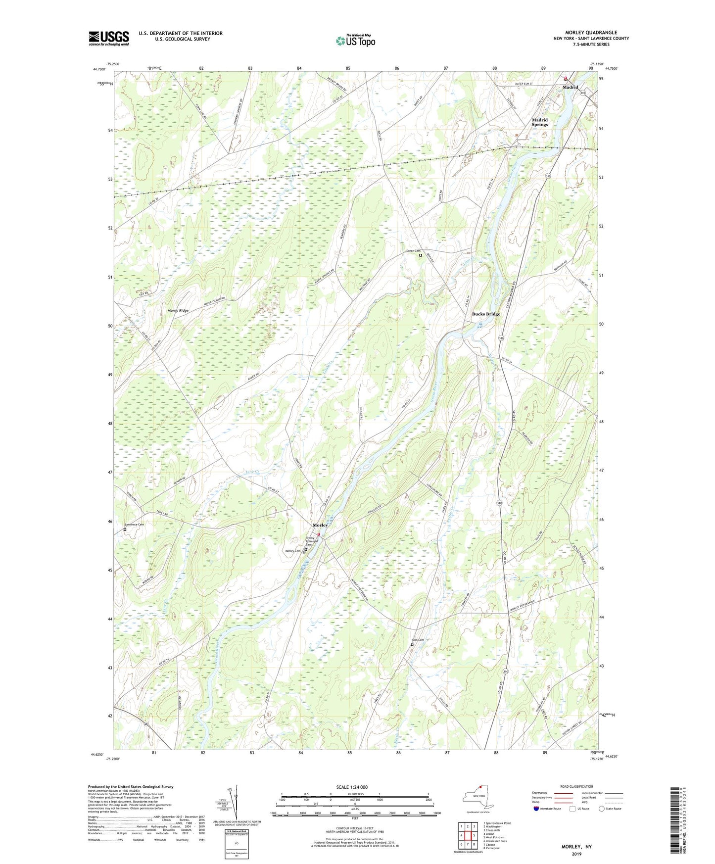
2023 topographic map quadrangle Morley in the state of New York. Scale: 1:24000. Based on the newly updated USGS 7.5' US Topo map series, this map is in the following counties: St. Lawrence. The map contains contour data, water features, and other items you are used to seeing on USGS maps, but also has updated roads and other features. This is the next generation of topographic maps. Printed on high-quality waterproof paper with UV fade-resistant inks.
Quads adjacent to this one:
West: Lisbon
Northwest: Sparrowhawk Point
North: Waddington
Northeast: Chase Mills
East: West Potsdam
Southeast: Pierrepont
South: Canton
Southwest: Rensselaer Falls
This map covers the same area as the classic USGS quad with code o44075f2.
Contains the following named places: Bucks Bridge, Canton Free Library Morley Branch, Casey Corners, Cedar Meadows Farm, Christian Fellowship Center, Doran Cemetery, Hague Crossing, Hepburn Public Library, Jordan Farms, Lawrence Cemetery, Line Creek, Madrid Census Designated Place, Madrid Central School, Madrid Golf Club, Madrid Post Office, Madrid Rescue Squad, Madrid Springs, Madrid Town Hall, Madrid Volunteer Fire Department, Madrid Water District Filter House And Pumping Station, Mapleview Dairy, Morey Ridge, Morley, Morley Cemetery, Morley Volunteer Fire Company, Nettle Creek, Olin Cemetery, Paradise Valley Farm, Pilgrim Holiness Church, Saint John's Roman Catholic Church, Trinity Episcopal Cemetery, Wesleyan Church