MyTopo
Waddington New York US Topo Map
Couldn't load pickup availability
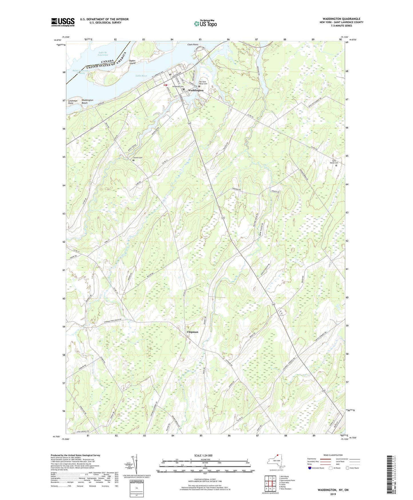
2023 topographic map quadrangle Waddington in the state of New York. Scale: 1:24000. Based on the newly updated USGS 7.5' US Topo map series, this map is in the following counties: St. Lawrence. The map contains contour data, water features, and other items you are used to seeing on USGS maps, but also has updated roads and other features. This is the next generation of topographic maps. Printed on high-quality waterproof paper with UV fade-resistant inks.
Quads adjacent to this one:
West: Sparrowhawk Point
Northeast: Louisville
East: Chase Mills
Southeast: West Potsdam
South: Morley
Southwest: Lisbon
This map covers the same area as the classic USGS quad with code o44075g2.
Contains the following named places: Brandy View Farms, Brookside Cemetery, Chipman, Clark Point, Cogswell Corners, Drews Corner, First Congregational Church, Halfway House Corners, Hamilton Gardens Assisted Living Facility, Harmony Farm, Harvest Dairy Farm, Henrys Corners, Leishman Point, Little River, Little Sucker Brook, Madrid, Madrid-Waddington High School, Ogden Island, Old Saint Marys Cemetery, Saint Marys Cemetery, School Number 11, School Number 12, School Number 13, School Number 2, School Number 31, School Number 4, School Number 6, School Number 8, School Number 9, Scotch Cemetery, Scotch Presbyterian Church, Sucker Brook, Town of Madrid, Town of Madrid Highway Department, Town of Waddington, Turnbull Corner, Twin Brooks Golf Course, Village of Waddington, Waddington, Waddington Beach, Waddington Hepburn Library, Waddington Post Office, Waddington Rescue Squad, Waddington Village Wastewater Treatment Facility, Wagners Corners, ZIP Codes: 13660, 13694