MyTopo
Stillwater Mountain New York US Topo Map
Couldn't load pickup availability
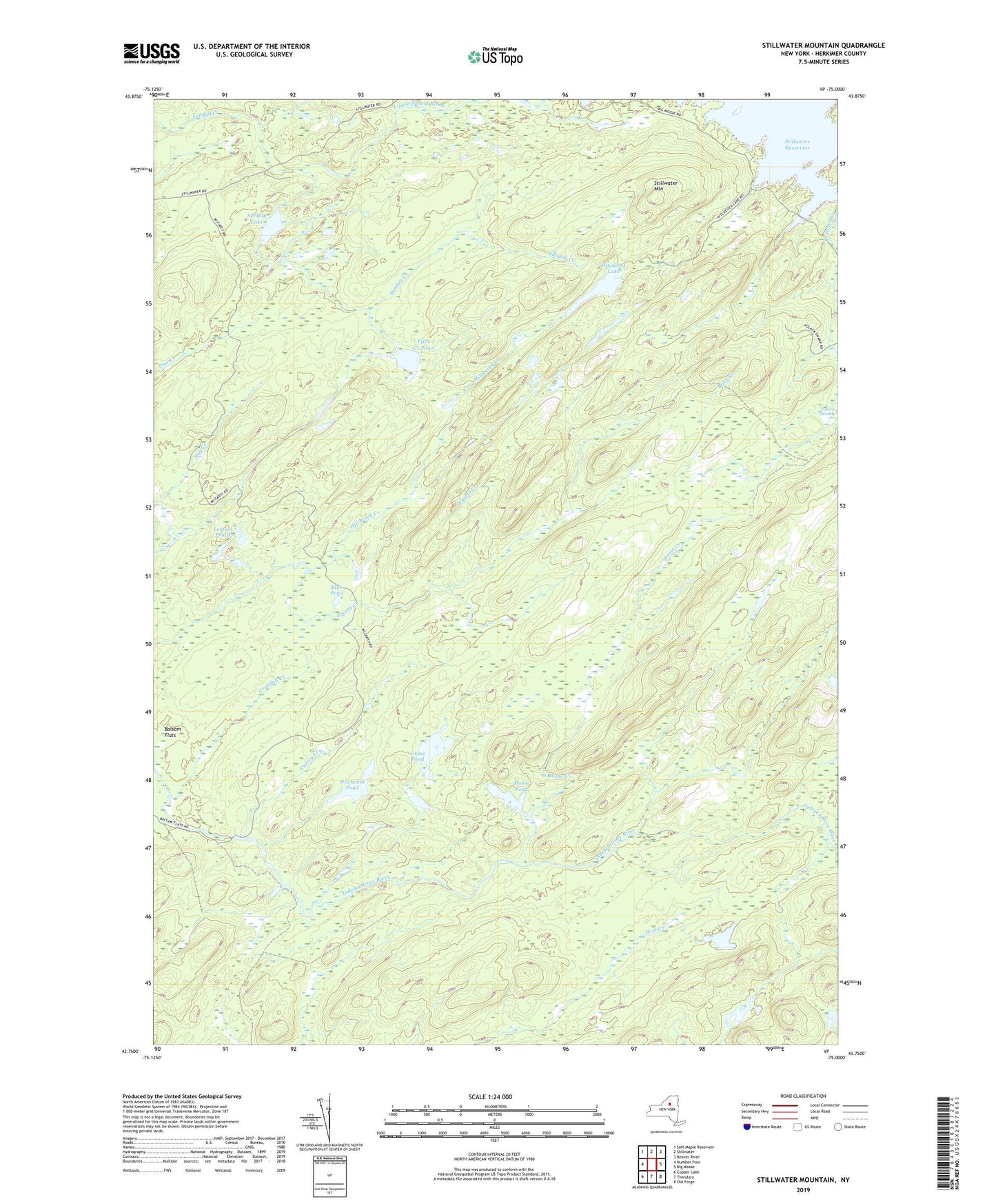
2019 topographic map quadrangle Stillwater Mountain in the state of New York. Scale: 1:24000. Based on the newly updated USGS 7.5' US Topo map series, this map is in the following counties: Herkimer. The map contains contour data, water features, and other items you are used to seeing on USGS maps, but also has updated roads and other features. This is the next generation of topographic maps. Printed on high-quality waterproof paper with UV fade-resistant inks.
Quads adjacent to this one:
West: Number Four
Northwest: Soft Maple Reservoir
North: Stillwater
Northeast: Beaver River
East: Big Moose
Southeast: Old Forge
South: Thendara
Southwest: Copper Lake
Contains the following named places: Balsam Flats, Blue Pond, Cherry Creek, Crondall Creek, Fifth Creek Pond, Grass Pond, Green Pond, Hay Creek, Hitchcock Creek, Hitchcock Lake, Hitchcock Pond, Lennon Ponds, Lizard Spring Brook, Moose Creek, Moose Pond, Polack Swamp, Stillwater Mountain, Sunday Lake, Twitchell Creek