MyTopo
Street Mountain New York US Topo Map
Couldn't load pickup availability
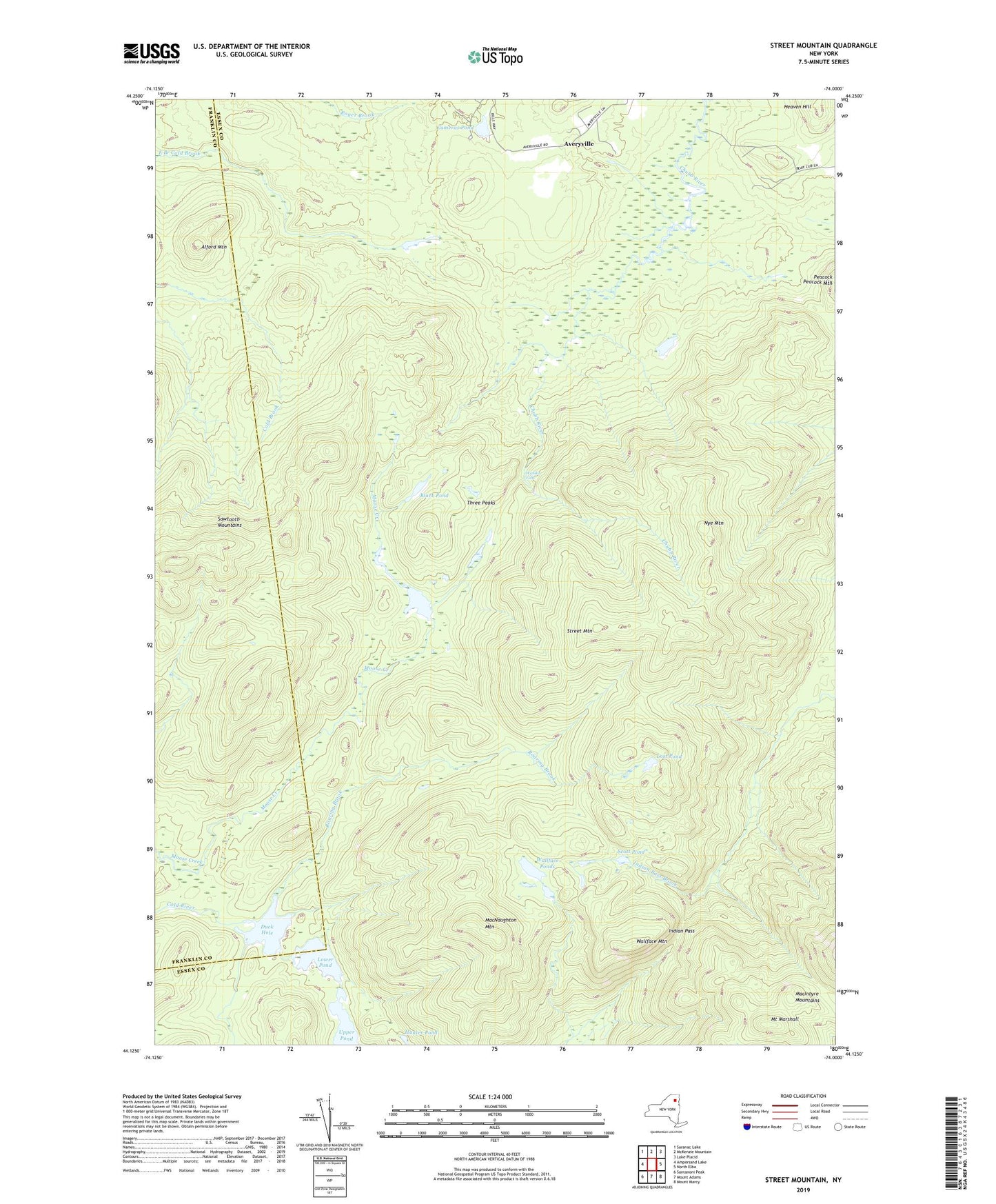
2019 topographic map quadrangle Street Mountain in the state of New York. Scale: 1:24000. Based on the newly updated USGS 7.5' US Topo map series, this map is in the following counties: Essex, Franklin. The map contains contour data, water features, and other items you are used to seeing on USGS maps, but also has updated roads and other features. This is the next generation of topographic maps. Printed on high-quality waterproof paper with UV fade-resistant inks.
Quads adjacent to this one:
West: Ampersand Lake
Northwest: Saranac Lake
North: McKenzie Mountain
Northeast: Lake Placid
East: North Elba
Southeast: Mount Marcy
South: Mount Adams
Southwest: Santanoni Peak
Contains the following named places: Alford Mountain, Averyville, Black Pond, Cameras Pond, Duck Hole, Heaven Hill, Hunter Pond, Indian Pass, Indian Pass Trail, Lost Pond, Lower Pond, MacIntyre Mountains, MacNaughton Mountain, Moose Pond, Mount Marshall, Nye Mountain, Preston Ponds, Roaring Brook, Sawtooth Mountains, Scott Pond, Street Mountain, Three Peaks, Upper Pond, Wallface Mountain, Wallface Ponds, Wanika Falls, ZIP Code: 12946