MyTopo
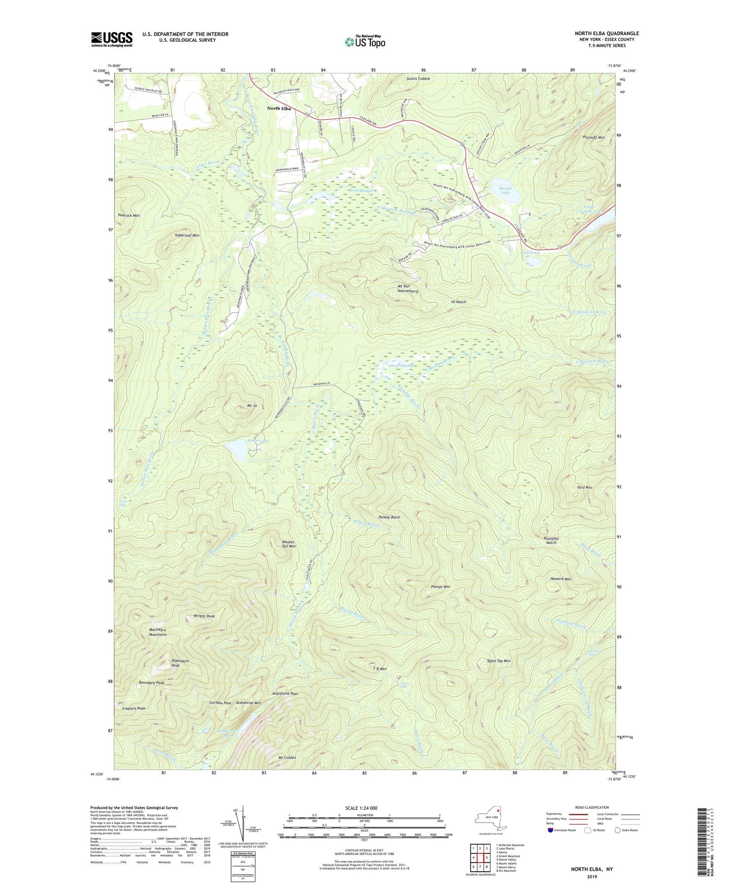
North Elba New York US Topo Map
Couldn't load pickup availability
2023 topographic map quadrangle North Elba in the state of New York. Scale: 1:24000. Based on the newly updated USGS 7.5' US Topo map series, this map is in the following counties: Essex. The map contains contour data, water features, and other items you are used to seeing on USGS maps, but also has updated roads and other features. This is the next generation of topographic maps. Printed on high-quality waterproof paper with UV fade-resistant inks.
Quads adjacent to this one:
West: Street Mountain
Northwest: McKenzie Mountain
North: Lake Placid
Northeast: Keene
East: Keene Valley
Southeast: Dix Mountain
South: Mount Marcy
Southwest: Mount Adams
Contains the following named places: Alder Brook, Algonquin Peak, Avalanche Lake, Avalanche Mountain, Avalanche Pass, Basin Brook, Biathlon Area, Boundary Peak, Bushnell Falls, Caribou Pass, Caribou Shelter, Chicken Coop Brook, Craig Wood Golf Course, Heart Lake, Hi-Notch, Hogback Shelter, Hopkins Trail, Howard Mountain, Indian Falls, Indian Pass Brook, Iroquois Peak, Kagel Shelter, Klondike Brook, Klondike Dam Camp, Klondike Notch, Lake Arnold, MacIntyre Brook, Marcy Brook, Marcy Dam, Mount Colden, Mount Jo, Mount Van Hoevenberg, Mount Van Hoevenburg Recreation Area, Mud Pond, North Country School, North Elba, North Meadow, North Meadow Brook, Olympic Bobsled Run, Peacock Mountain, Pelkey Basin, Pelkey Brook, Phelps Brook, Phelps Mountain, Phelps Trail, Pitchoff Mountain, Rocky Falls, Round Lake, Scotts Cobble, Shady Corner Curve, Slant Rock, South Meadow, South Meadow Brook, Sugarloaf Mountain, T R Mountain, Table Top Mountain, Town of North Elba, Upper Cascade Lake, Whales Tail Mountain, Wright Peak, Yard Mountain