MyTopo
Tooley Pond New York US Topo Map
Couldn't load pickup availability
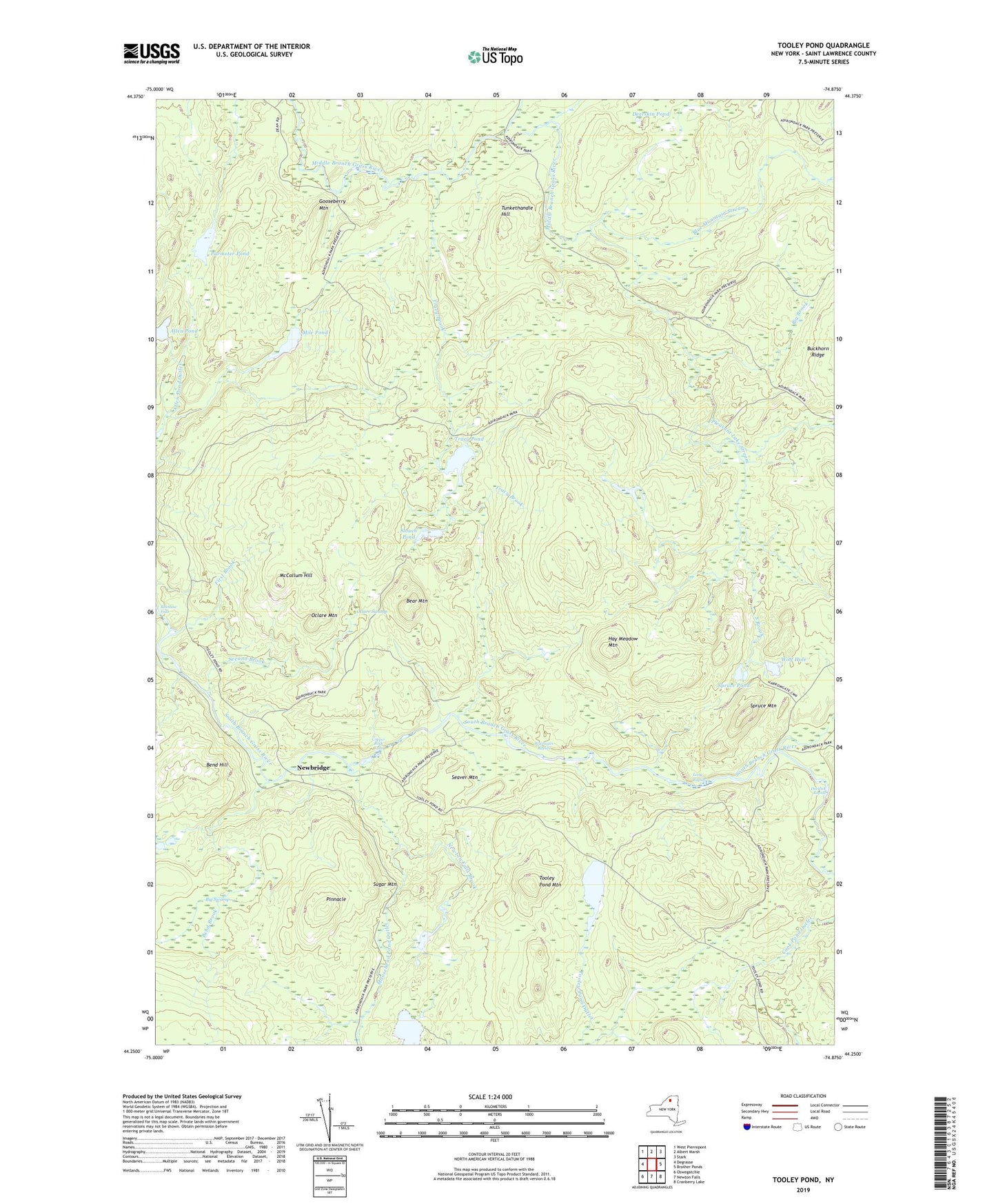
2019 topographic map quadrangle Tooley Pond in the state of New York. Scale: 1:24000. Based on the newly updated USGS 7.5' US Topo map series, this map is in the following counties: St. Lawrence. The map contains contour data, water features, and other items you are used to seeing on USGS maps, but also has updated roads and other features. This is the next generation of topographic maps. Printed on high-quality waterproof paper with UV fade-resistant inks.
Quads adjacent to this one:
West: Degrasse
Northwest: West Pierrepont
North: Albert Marsh
Northeast: Stark
East: Brother Ponds
Southeast: Cranberry Lake
South: Newton Falls
Southwest: Oswegatchie
Contains the following named places: Allen Pond, Bear Mountain, Bend Brook, Bend Hill, Big Brook, Big Swamp, Blue Mountain Stream, Brumagin Rapids, Canton Farm, Copper Rock Falls, Deerlick Rapids, Deerskin Creek, Deerskin Pond, First Brook, Gooseberry Mountain, Hay Meadow Mountain, Long Rapids, McCollum Hill, Mile Pond, Moosehead Pond, Moosehead Pond Outlet, Mud Brook, Newbridge, Newton Falls Brook, Oclare Mountain, Oclare Swamp, Parmeter Pond, Pinnacle, Pleasant Lake Stream, Rainbow Falls, Seaver Mountain, Second Brook, Slouch Pond, South Brook, Spruce Mountain, Spruce Pond, Sugar Mountain, Tooley Pond, Tooley Pond Mountain, Town of Clare, Tracy Brook, Tracy Pond, Tunkethandle Hill, Wolf Hole