MyTopo
West Chazy New York US Topo Map
Couldn't load pickup availability
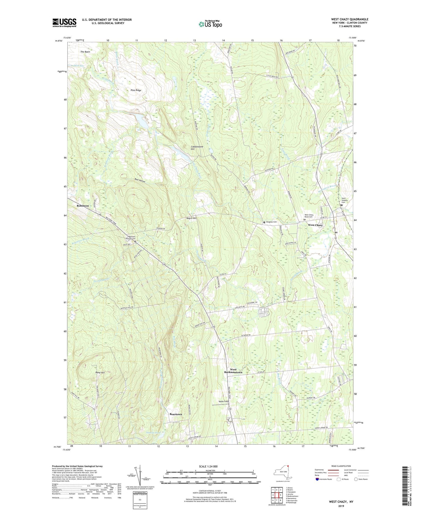
2019 topographic map quadrangle West Chazy in the state of New York. Scale: 1:24000. Based on the newly updated USGS 7.5' US Topo map series, this map is in the following counties: Clinton. The map contains contour data, water features, and other items you are used to seeing on USGS maps, but also has updated roads and other features. This is the next generation of topographic maps. Printed on high-quality waterproof paper with UV fade-resistant inks.
Quads adjacent to this one:
West: Jericho
Northwest: Altona
North: Mooers
Northeast: Champlain
East: Beekmantown
Southeast: Plattsburgh
South: Morrisonville
Southwest: Dannemora
Contains the following named places: Bear Hollow, Beartown, Beartown School, Cobblestone Hill, Cold Brook, Dead Sea, Dodge Library, Douglas School, Douglass Cemetery, Duncan Pond, Farrell Brook, Negro Hill, Pine Ridge, Rand Hill, Robinson, Robinson Brook, Robinson District Cemetery, Saint Josephs Cemetery, School Number 2, School Number 4, School Number 5, School Number 8, Stony Acres Mobile Home Park, The Basin, Twin Ells Mobile Home Park, Vasile Field, WCFE-FM (Plattsburgh), West Beekmantown, West Chazy, West Chazy Census Designated Place, West Chazy Post Office, West Chazy Rural Cemetery, WGFB-FM (Plattsburgh), Witherill School, ZIP Codes: 12910, 12992