MyTopo
Ammon North Carolina US Topo Map
Couldn't load pickup availability
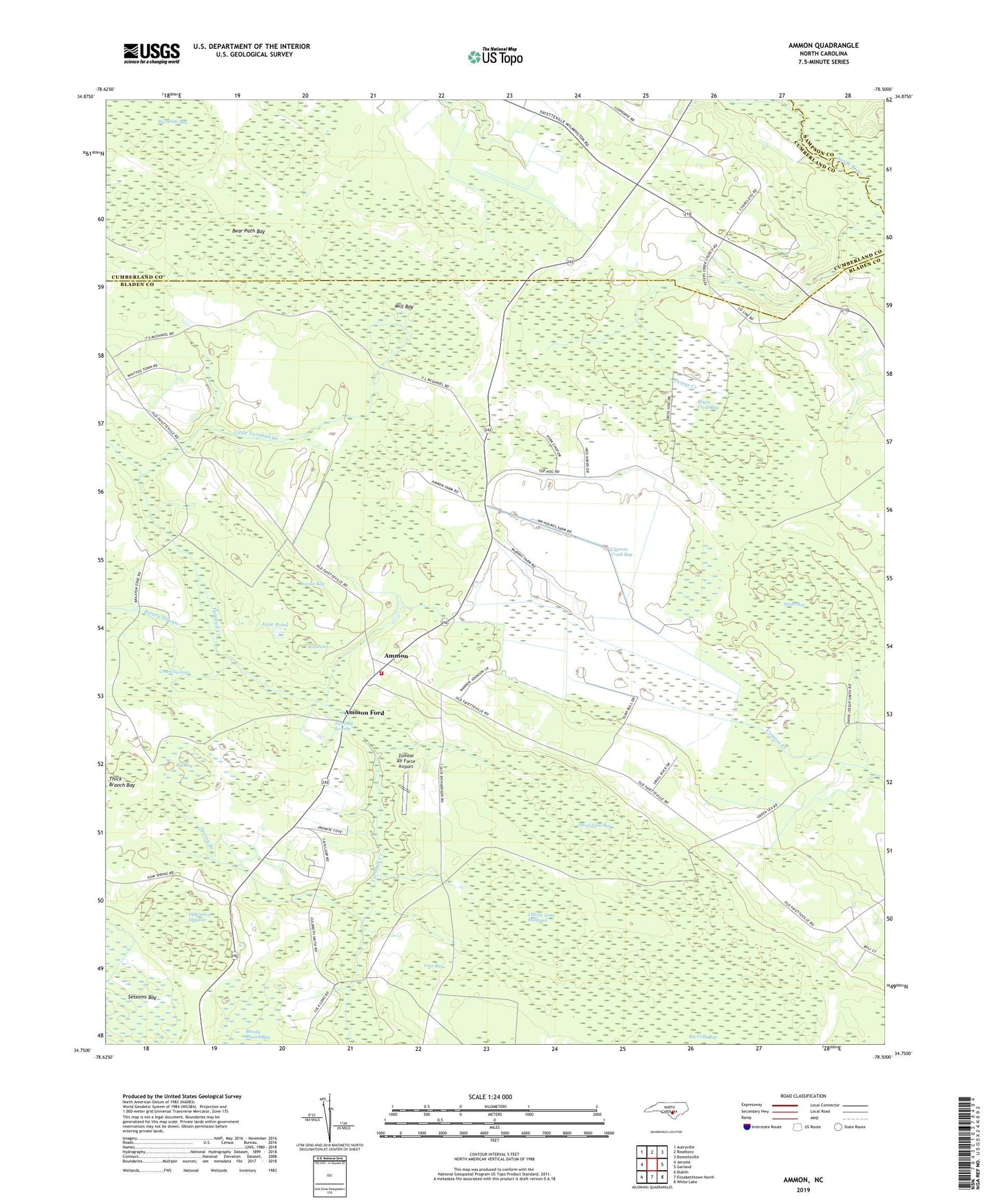
2019 topographic map quadrangle Ammon in the state of North Carolina. Scale: 1:24000. Based on the newly updated USGS 7.5' US Topo map series, this map is in the following counties: Bladen, Cumberland, Sampson. The map contains contour data, water features, and other items you are used to seeing on USGS maps, but also has updated roads and other features. This is the next generation of topographic maps. Printed on high-quality waterproof paper with UV fade-resistant inks.
Quads adjacent to this one:
West: Jerome
Northwest: Autryville
North: Roseboro
Northeast: Bonnetsville
East: Garland
Southeast: White Lake
South: Elizabethtown North
Southwest: Dublin
Contains the following named places: Ammon, Ammon Ford, Ammon Volunteer Fire Department, Bear Path Bay, Beaver Dam Creek, Big Bay, Big Colly Bay, Briary Stream, Cain Bay, Charlie Long Millpond, Corson Bay, Cypress Creek Bay, David Gam Bay, Dickenson Meadow, Green Swamp, Jane Pond, Little Turnbull Creek, Mill Bay, Peters Creek, Peters Creek Bay, Peters Creek Church, Red Pond, Reeves Ford, Saint Matthews Church, Smith Bay, Spring Branch, Township of Turnbull, Turnbull Swamp, Windsor Church, Zombie Air Force Airport