MyTopo
Ayden North Carolina US Topo Map
Couldn't load pickup availability
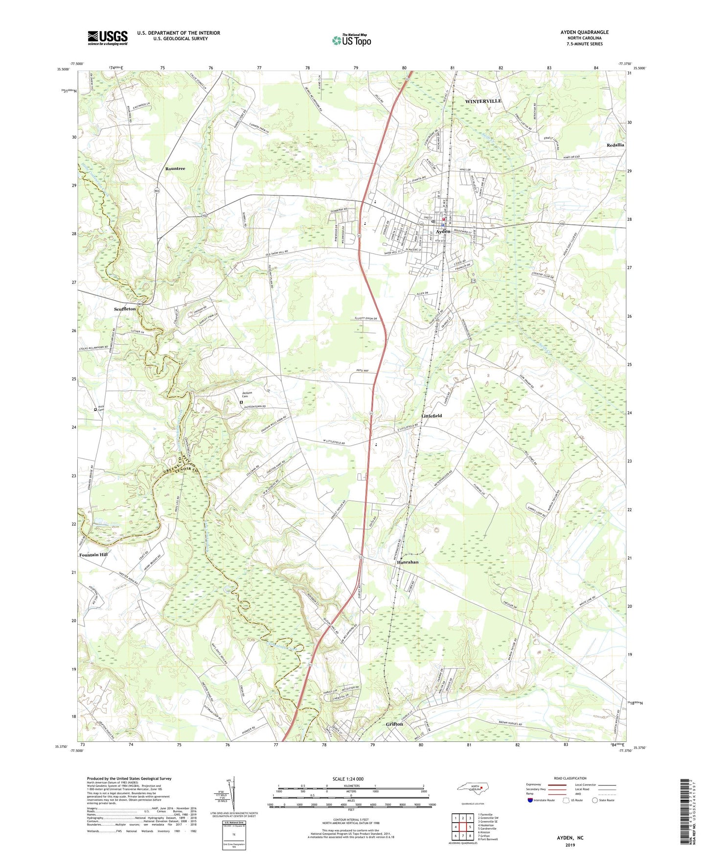
2022 topographic map quadrangle Ayden in the state of North Carolina. Scale: 1:24000. Based on the newly updated USGS 7.5' US Topo map series, this map is in the following counties: Pitt, Lenoir, Greene. The map contains contour data, water features, and other items you are used to seeing on USGS maps, but also has updated roads and other features. This is the next generation of topographic maps. Printed on high-quality waterproof paper with UV fade-resistant inks.
Quads adjacent to this one:
West: Hookerton
Northwest: Farmville
North: Greenville SW
Northeast: Greenville SE
East: Gardnerville
Southeast: Fort Barnwell
South: Grifton
Southwest: Kinston
This map covers the same area as the classic USGS quad with code o35077d4.
Contains the following named places: Anointed One Church of Deliverance, Artis Cemetery, Ayden, Ayden Elementary School, Ayden Fire Rescue and Emergency Medical Services Department, Ayden First Pentecostal Holiness Church, Ayden Golf and Country Club, Ayden Middle School, Ayden Police Department, Ayden Post Office, Ayden Rescue Squad, Ayden-Grifton High School, Belair Estates, Britthaven of Ayden, Community Church, Cresent Heights Mobile Home Park, Deerfield, Edwards Bridge, Elm Grove Church, Faith Baptist Church, Grifton Police Department Non Emergency, Hancock Church, Hanrahan, Jackson Cemetery, Jumping Run Church, Kennedy Estates, Liberty Church, Little Contentnea Creek, Little Creek Church, Littlefield, New Deliverance Free Will Baptist Church, North Hills Estates, Open Heart Church of God, Pleasant Plains Church, Pleasant Ridge, Redallia, Rountree, Saint Jude Church, Scuffleton, Strawberry Banks, The Pines, Town of Ayden, Township of Ayden, Township of Grifton, Zion Chapel, ZIP Code: 28513