MyTopo
Fort Barnwell North Carolina US Topo Map
Couldn't load pickup availability
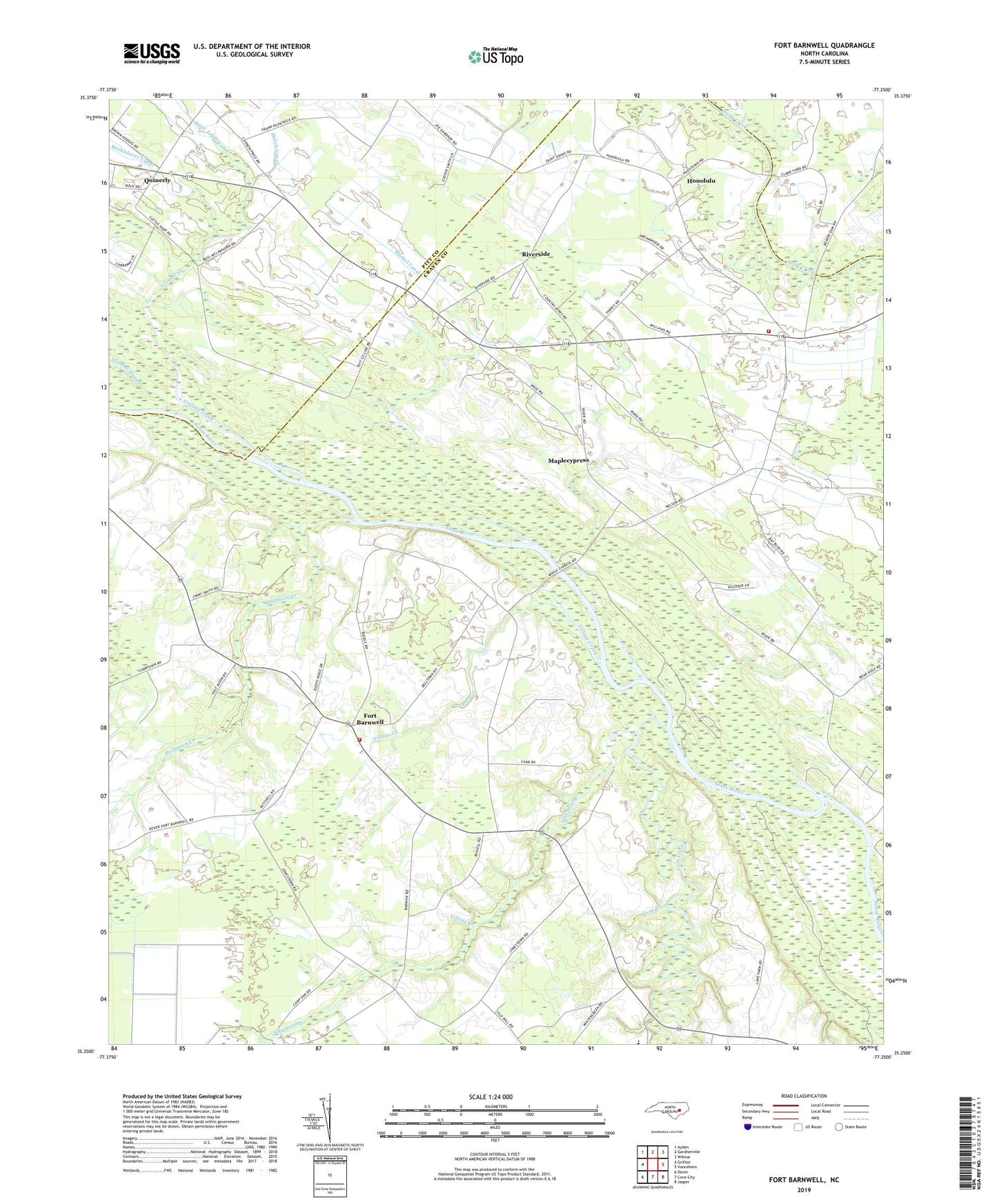
2022 topographic map quadrangle Fort Barnwell in the state of North Carolina. Scale: 1:24000. Based on the newly updated USGS 7.5' US Topo map series, this map is in the following counties: Craven, Pitt. The map contains contour data, water features, and other items you are used to seeing on USGS maps, but also has updated roads and other features. This is the next generation of topographic maps. Printed on high-quality waterproof paper with UV fade-resistant inks.
Quads adjacent to this one:
West: Grifton
Northwest: Ayden
North: Gardnerville
Northeast: Wilmar
East: Vanceboro
Southeast: Jasper
South: Cove City
Southwest: Dover
This map covers the same area as the classic USGS quad with code o35077c3.
Contains the following named places: Bear Branch, Biddle Landing, Buckleberry Canal, Core Creek, Core Creek Landing, Cox Landing, Ditch Landing, Dudley Landing, Epworth Church, Flat Swamp, Fort Barnwell, Fort Barnwell Elementary School, Fort Barnwell Rescue Squad, Fort Barnwell Volunteer Fire Department, Grinnel Creek, Halfmoon Creek, Harris Landing, Honolulu, Lighthouse Mennonite Church, Maplecypress, Markel Canal, Mount Zion Church, Piney Grove Church, Pitchkettle Church, Pitchkettle Landing, Quinerly, Riverside, Saint Edward Church, Saint John Church, Saint Johns, Saint Johns Canal, Saint Marys Church, Shiloh Canal, Shiloh Church, Vanceboro Rural Volunteer Fire Department, Village Creek, Village Landing, WOW Youth Camp, ZIP Code: 28526