MyTopo
Banoak North Carolina US Topo Map
Couldn't load pickup availability
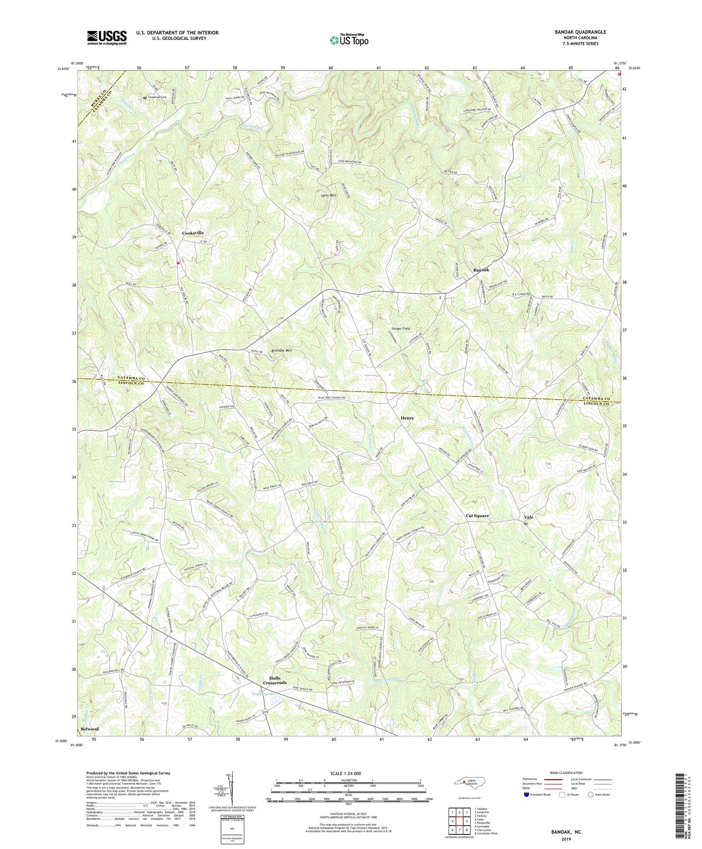
2022 topographic map quadrangle Banoak in the state of North Carolina. Scale: 1:24000. Based on the newly updated USGS 7.5' US Topo map series, this map is in the following counties: Lincoln, Catawba, Burke, Cleveland. The map contains contour data, water features, and other items you are used to seeing on USGS maps, but also has updated roads and other features. This is the next generation of topographic maps. Printed on high-quality waterproof paper with UV fade-resistant inks.
Quads adjacent to this one:
West: Casar
Northwest: Valdese
North: Longview
Northeast: Hickory
East: Reepsville
Southeast: Lincolnton West
South: Cherryville
Southwest: Lawndale
This map covers the same area as the classic USGS quad with code o35081e4.
Contains the following named places: Banoak, Banoak Elementary School, Brendle Mountain, Cat Square, Cedar Grove Church, Chapman Cemetery, Cooksville, Cooksville Volunteer Fire Department Station 14, Corinth Church, Douglas Creek, Hebron Church, Henry, Hulls Crossroads, Hulls Grove Church, Little Indian Creek, Lynn Mountain, Macedonia Church, Mount Calvary Church, Mount Vernon Church, Mulls Chapel, North Brook School Number 3, Palm Tree Church, Propst Crossroads Volunteer Fire Department, Reeps Grove Church, Richardson Creek, Rock Creek, Sardis Church, Seagles Store, Steiger Field, Taylors Lake, Taylors Lake Dam, Township of Bandy's, Travis Chapel, Trinity Church, Vale, Vale Post Office, West Lincoln Rescue Squad, Wrays Crossroads, ZIP Code: 28168