MyTopo
Reepsville North Carolina US Topo Map
Couldn't load pickup availability
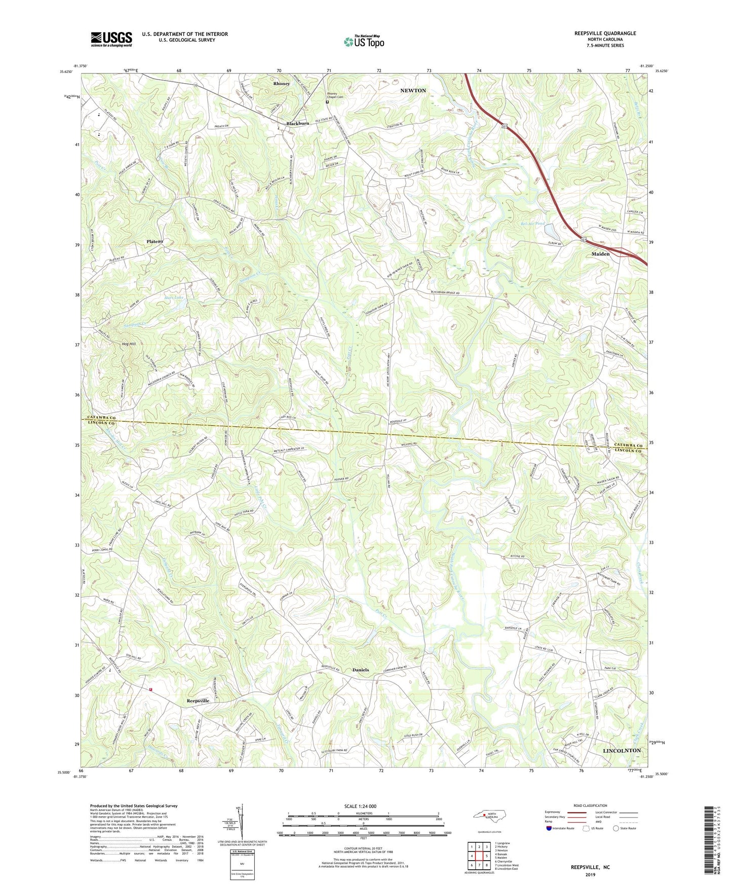
2022 topographic map quadrangle Reepsville in the state of North Carolina. Scale: 1:24000. Based on the newly updated USGS 7.5' US Topo map series, this map is in the following counties: Catawba, Lincoln. The map contains contour data, water features, and other items you are used to seeing on USGS maps, but also has updated roads and other features. This is the next generation of topographic maps. Printed on high-quality waterproof paper with UV fade-resistant inks.
Quads adjacent to this one:
West: Banoak
Northwest: Longview
North: Hickory
Northeast: Newton
East: Maiden
Southeast: Lincolnton East
South: Lincolnton West
Southwest: Cherryville
This map covers the same area as the classic USGS quad with code o35081e3.
Contains the following named places: Bel-Air Pond, Bel-Air Pond Dam, Bethel Church, Blackburn, Blackburn Elementary School, Carpenter Creek, Cedar Grove Church, Cow Branch, Crowell Church, Daniels, Davis Chapel, Fred T Foard High School, Grace Church, Haas Creek, Hart Lake, Hart Lake Dam, Hog Hill, Howards Creek Mill, Jacobs Fork Church, John Grace Church, Larkard Creek, Leatherman Dam, Leatherman Lake, Little Pott Creek, Macedonia Church, New Hope Church, Plateau, Pleasant, Pott Creek, Reepsville, Rhodes Mill Creek, Rhoney Chapel Cemetery, Russells Chapel, Salem Church, Sampson Creek, Township of Jacobs Fork, Union School, Union Volunteer Fire Department, Wesleys Chapel