MyTopo
Bunn West North Carolina US Topo Map
Couldn't load pickup availability
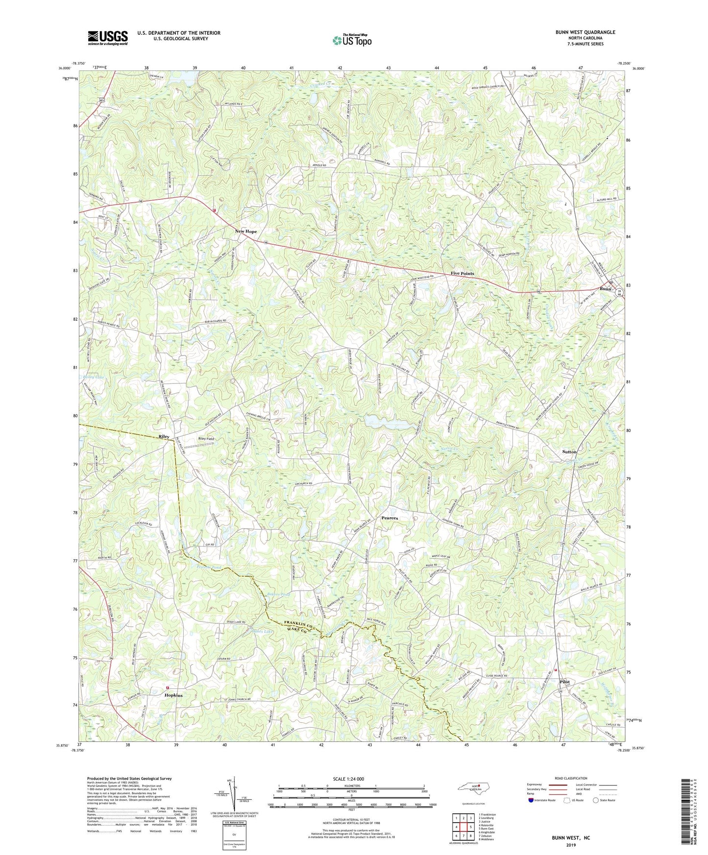
2022 topographic map quadrangle Bunn West in the state of North Carolina. Scale: 1:24000. Based on the newly updated USGS 7.5' US Topo map series, this map is in the following counties: Franklin, Wake. The map contains contour data, water features, and other items you are used to seeing on USGS maps, but also has updated roads and other features. This is the next generation of topographic maps. Printed on high-quality waterproof paper with UV fade-resistant inks.
Quads adjacent to this one:
West: Rolesville
Northwest: Franklinton
North: Louisburg
Northeast: Justice
East: Bunn East
Southeast: Middlesex
South: Zebulon
Southwest: Knightdale
This map covers the same area as the classic USGS quad with code o35078h3.
Contains the following named places: Bailey Lake, Bakers Pond, Bethlehem Church, Bunn, Bunn Fire Department Station 2, Bunn Post Office, Bunn Rescue and Emergency Medical Services, Cliftons Pond, Dukes Lake, Five Points, Gethsemane Church, Gethsemane School, Halls Crossroads, Hopkins, Hopkins Chapel, Hopkins Rural Fire Department Station 22, Lands Pond, Lands Pond Dam, New Harris School, New Hope, Norris Creek, Pearces, Perry Pond Dam, Perrys Pond, Phelps Chapel, Pierce School, Pilot, Pilot Volunteer Fire and Rescue Department, Poplar Springs Church, Privetts Pond, Riley, Riley Field, Rock Spring Church, Saint Johns Church, Smiths Pond, Smiths Pond Dam, Sutton, Town of Bunn, Township of Dunn, Township of Harris, Union Gospel Tabernacle, White Oak Church, Zebulon Country Club