MyTopo
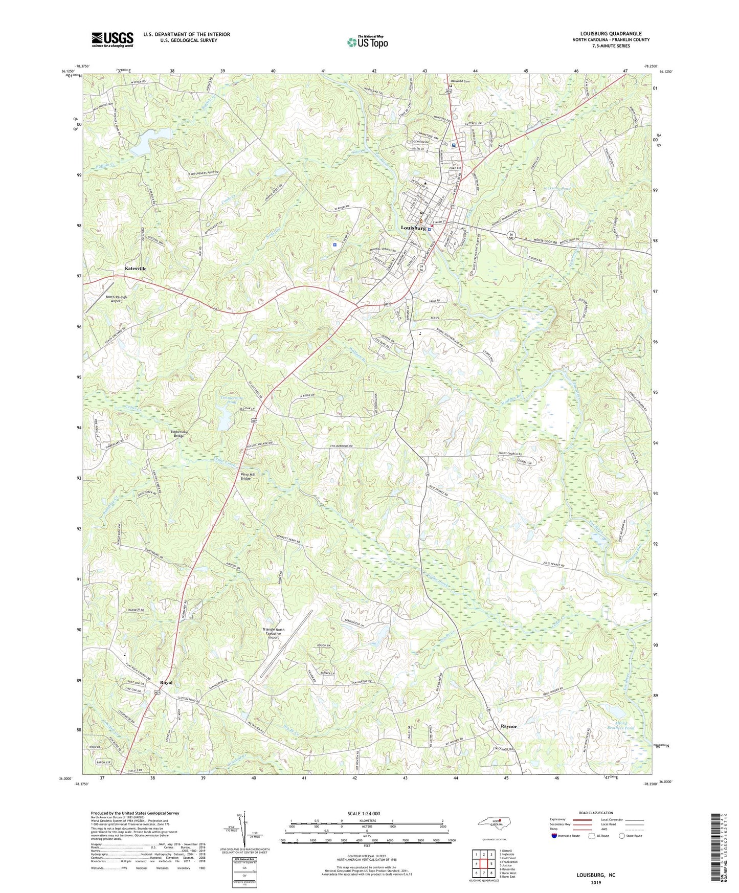
Louisburg North Carolina US Topo Map
Couldn't load pickup availability
2022 topographic map quadrangle Louisburg in the state of North Carolina. Scale: 1:24000. Based on the newly updated USGS 7.5' US Topo map series, this map is in the following counties: Franklin. The map contains contour data, water features, and other items you are used to seeing on USGS maps, but also has updated roads and other features. This is the next generation of topographic maps. Printed on high-quality waterproof paper with UV fade-resistant inks.
Quads adjacent to this one:
West: Franklinton
Northwest: Kittrell
North: Ingleside
Northeast: Gold Sand
East: Justice
Southeast: Bunn East
South: Bunn West
Southwest: Rolesville
This map covers the same area as the classic USGS quad with code o36078a3.
Contains the following named places: Alford Brothers Pond, Bear Swamp Creek, Big Branch Creek, Camping Creek, Cedar Creek, Cliftons Pond Dam, Coole Creek, Fox Creek, Franklin County, Franklin County Emergency Services, Franklin County Sheriff's Office, Franklin Plaza, Frazier Field, Green Hall School, Griffin Airport, Hill King Church, Jacksons Pond, Jumping Run, Katesville, Leahs Chapel, Louisburg, Louisburg College, Louisburg Elementary School, Louisburg Fire Department, Louisburg High School, Louisburg Police Department, Louisburg Post Office, Louisburg Rescue and Emergency Medical Services, Maria Parham Franklin Hospital, Mitchiners Pond, Mitchiners Pond Dam, Neal Gut, North Raleigh Airport, Oakwood Cemetery, Perry Mill Bridge, Ransdell Chapel Baptist Church, Raynor, River Bend Park, Royal, Shady Grove Church, Shannon Village Shopping Center, Sycamore Creek, Timberlake Bridge, Timmerman Pond, Timmerman Pond Dam, Town of Louisburg, Township of Louisburg, Triangle North Executive Airport, Wolfpen Branch, WYRN-AM (Louisburg)


