MyTopo
Franklinton North Carolina US Topo Map
Couldn't load pickup availability
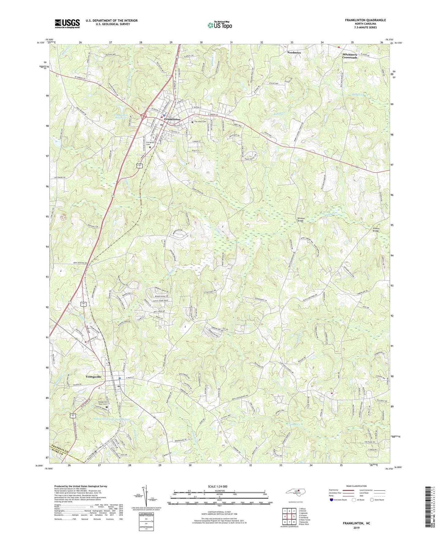
2022 topographic map quadrangle Franklinton in the state of North Carolina. Scale: 1:24000. Based on the newly updated USGS 7.5' US Topo map series, this map is in the following counties: Franklin, Wake. The map contains contour data, water features, and other items you are used to seeing on USGS maps, but also has updated roads and other features. This is the next generation of topographic maps. Printed on high-quality waterproof paper with UV fade-resistant inks.
Quads adjacent to this one:
West: Grissom
Northwest: Wilton
North: Kittrell
Northeast: Ingleside
East: Louisburg
Southeast: Bunn West
South: Rolesville
Southwest: Wake Forest
This map covers the same area as the classic USGS quad with code o36078a4.
Contains the following named places: Albian Academy, Allens Church, Brandy Creek, Calvin Ray Pond Dam, Central Academy, Christian College, Ebenezer Church, Evergreen Cemetery, Fair View Cemetery, Flat Rock Church, Franklinton, Franklinton Elementary School, Franklinton Fire Department, Franklinton High School, Franklinton Police Department, Franklinton Post Office, Franklinton Reservoir, Franklinton Reservoir Dam, Franklinton Reservoir Number Two, Greens Bridge, Holy Trinity Church, Junction Plaza, Kearneys Creek Dam, Liberty School, Little Zion Church, Manassas Church, Mays Crossroads, Mitchiners Crossroads, Mitchiners Crossroads Rural Fire Station, Needmore, New Liberty Church, Oak Level Church, Old Liberty Church, Perrys Chapel, Popes Crossroads, Thomas Lake, Thomas Lake Dam, Town of Franklinton, Town of Youngsville, Township of Franklinton, Township of Youngsville, Union Grove Church, Willowhaven Lake Number Two, Winston Bridge, Youngsville, Youngsville Fire Department Station 1, Youngsville Fire Station 2, Youngsville Police Department, Youngsville Post Office, Youngsville Rescue Squad, Youngsville School, Youngsville Town Cemetery