MyTopo
Caldwell North Carolina US Topo Map
Couldn't load pickup availability
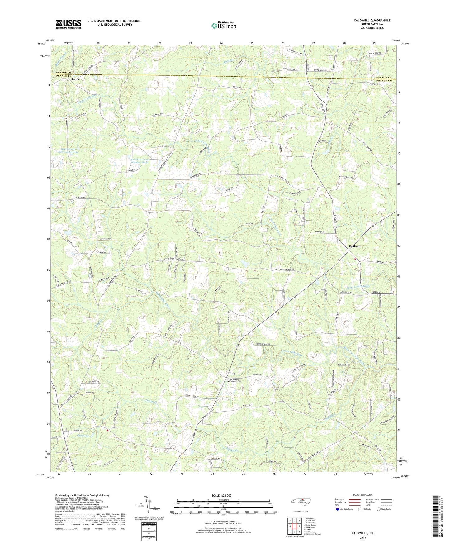
2019 topographic map quadrangle Caldwell in the state of North Carolina. Scale: 1:24000. Based on the newly updated USGS 7.5' US Topo map series, this map is in the following counties: Orange, Person. The map contains contour data, water features, and other items you are used to seeing on USGS maps, but also has updated roads and other features. This is the next generation of topographic maps. Printed on high-quality waterproof paper with UV fade-resistant inks.
Quads adjacent to this one:
West: Cedar Grove
Northwest: Ridgeville
North: Hurdle Mills
Northeast: Timberlake
East: Rougemont
Southeast: Northwest Durham
South: Hillsborough
Southwest: Efland
Contains the following named places: Ashleys Lake, Ashleys Lake Dam, Berryland, Berrys Grove Church, Caldwell, Caldwell Fire Department, Cascades, Charter Meadows, Forrest Creek, Glengrove Church, Jones Grove Church, Kindful Acres, Larry Hall, Lattisville Grove Church, Laws, Little River Church, North Fork, Obies Chapel, Orange Rural Fire Department Station 2, Payne Chapel AME Church Cemetery, Paynes Chapel, Quail Roost Lake Number One, Quail Roost Lake Number Three, Rays Creek, Schley, Springcrest Meadows, Stone Pond, Stone Pond Dam, Township of Little River, Walnut Grove Church