MyTopo
Hillsborough North Carolina US Topo Map
Couldn't load pickup availability
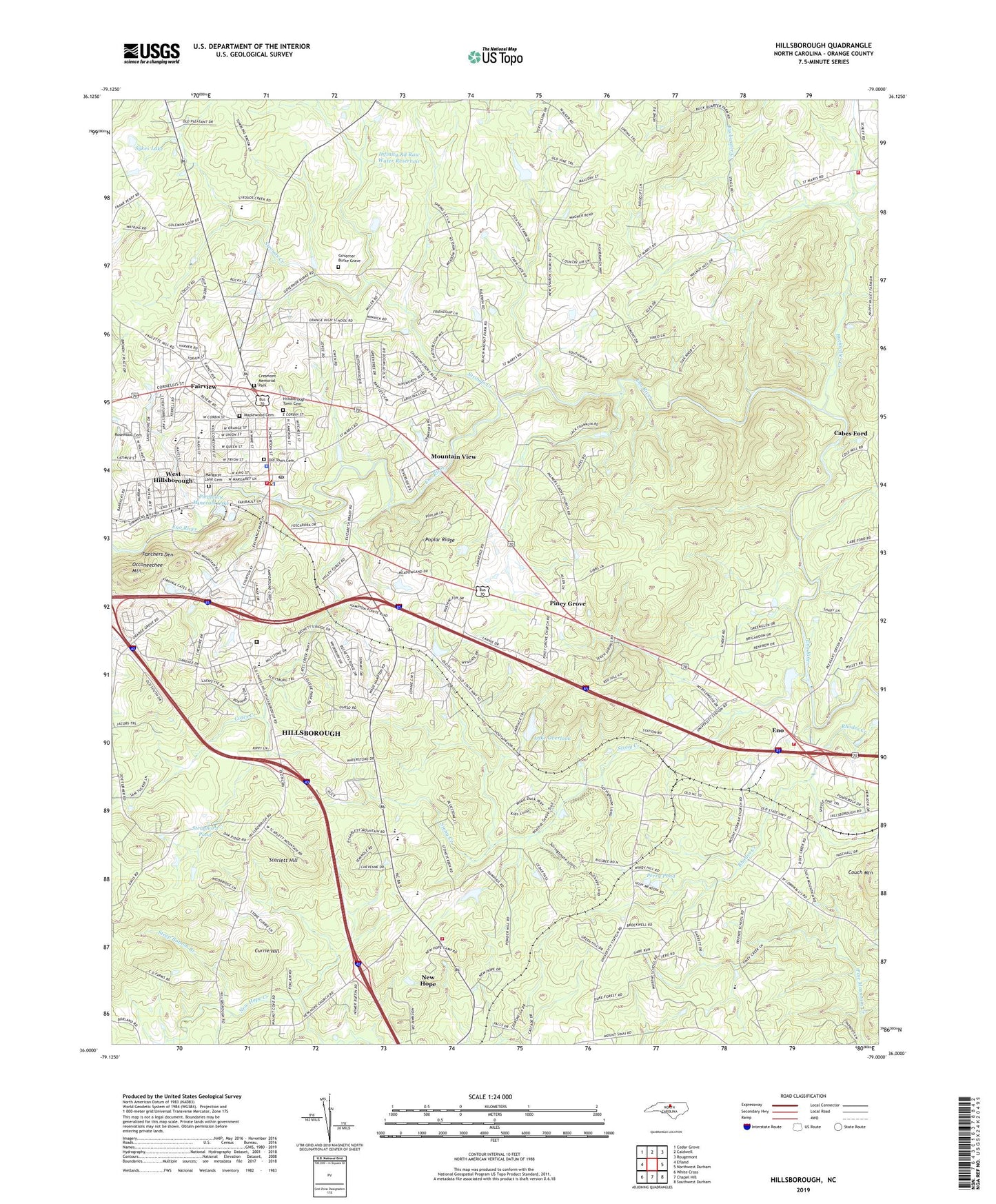
2022 topographic map quadrangle Hillsborough in the state of North Carolina. Scale: 1:24000. Based on the newly updated USGS 7.5' US Topo map series, this map is in the following counties: Orange. The map contains contour data, water features, and other items you are used to seeing on USGS maps, but also has updated roads and other features. This is the next generation of topographic maps. Printed on high-quality waterproof paper with UV fade-resistant inks.
Quads adjacent to this one:
West: Efland
Northwest: Cedar Grove
North: Caldwell
Northeast: Rougemont
East: Northwest Durham
Southeast: Southwest Durham
South: Chapel Hill
Southwest: White Cross
This map covers the same area as the classic USGS quad with code o36079a1.
Contains the following named places: Ben Johnson Lake, Ben Johnson Lake Dam, Bluffs of Eno, Brigadoon, Buckquarter Creek, Cabes Ford, Cameron Park Elementary School, Cameron Park School, Carolina Friends School, Cates Creek, Central Elementary School, Central High School, Central School, Colonial Hills, Colonial Park, Cornwallis Hills, Couch Mountain, County Subsidiary Prison Number 056, Cresmont Memorial Park, Currie Hill, Dimmocks Mill, Eastwood, Eno, Eno Fire and Emergency Services, Eno River State Park, Exchange Club Park, Fairview, Falls of New Hope, Flat Rock Church, Fox Pond Dam, Freeland Dam, Governor Burke Grave, Grady A Brown Elementary School, Greenbriar, Hideaway Estates, Hillcrest, Hillsborough, Hillsborough Fire Department - Orange Rural Fire Department Station 1, Hillsborough Police Department, Hillsborough Post Office, Hillsborough Town Cemetery, Infinity Rd Raw Water Reservoir, Jappa Oaks, Kingsboro Estates, Lake Overlook, Little Creek, Maplewood Cemetery, Margaret Lane Cemetery, Mars Hill Church, Mount Hermon Church, Mountain View, New Hope, New Hope Elementary School, New Hope Volunteer Fire Department Station 2, New Sharon Church, Oak Ridge, Oakdale Farms, Occoneechee Mountain, Old Town Cemetery, Orange Correctional Center, Orange County, Orange County Emergency Medical Services, Orange County Rescue Squad, Orange County Sheriff's Office, Orange Heights, Orange High School, Orange Junior High School, Palmers Grove Church, Panthers Den, Perry Pond, Piedmont Minerals Dam, Piedmont Minerals Lake, Piney Grove, Poplar Ridge, Rosewood, Saint Marys Church, Scarlett Hill, Stagecoach Run, Steep Bottom Branch, Stony Creek, Strayhorn Hills, Strayhorn Pond, Strayhorn Pond Dam, Strouds Creek, Sunshine Acres, Sykes Lake, Temple of Truth, Town of Hillsborough, Township of Eno, Township of Hillsborough, University, University Acres, Walnut Cove, Wayside Church, West Hillsborough, Whispering Pines, Wildwood, Wilkerson Acres, Windy Hill Farm, ZIP Code: 27278