MyTopo
Efland North Carolina US Topo Map
Couldn't load pickup availability
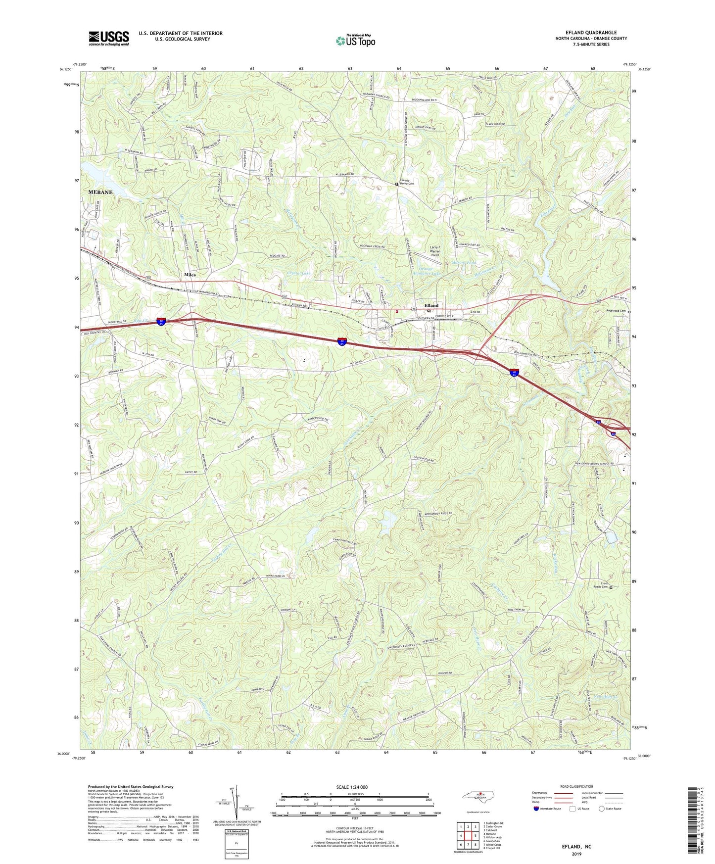
2022 topographic map quadrangle Efland in the state of North Carolina. Scale: 1:24000. Based on the newly updated USGS 7.5' US Topo map series, this map is in the following counties: Orange. The map contains contour data, water features, and other items you are used to seeing on USGS maps, but also has updated roads and other features. This is the next generation of topographic maps. Printed on high-quality waterproof paper with UV fade-resistant inks.
Quads adjacent to this one:
West: Mebane
Northwest: Burlington NE
North: Cedar Grove
Northeast: Caldwell
East: Hillsborough
Southeast: Chapel Hill
South: White Cross
Southwest: Saxapahaw
This map covers the same area as the classic USGS quad with code o36079a2.
Contains the following named places: Allens Chapel, Calvary Church, Camp Chestnut Ridge, Cheeks Crossroads, Chestnut Ridge Church, Cooper Grove Church, County Home Cemetery, Crabtree Creek, Cross Roads Cemetery, Cross Roads Church, Crystal Lake, Dry Run, Efland, Efland Census Designated Place, Efland Post Office, Efland Volunteer Fire Department, Efland-Cheeks School, Fairfield Church, Faith Tabernacle, Fellowship Lake Dam, Flying Elephant Ranch, Garland Acres, Harvest Chapel, Holly Meadows, Jordan Oak, Lake Michael, Lake Michael Dam, Larry F Warren Field, Lebanon Church, Masons Pond, McGowan Creek, Miles, Oak Grove Church, Orange Crossroads Church, Orange-Alamance Lake, Orange-Alamance Lake Dam, Perry Hills, Rivins Lake Dam, Rocky Run, Rosewood Cemetery, Seven Mills Farms, Sevenmile Creek, Smiths Lake Dam, Stagecoach Forest, Sugar Ridge, Sunset Ridge, The Peoples Church, Township of Cheeks, White Cross Church, ZIP Code: 27243