MyTopo
Casar North Carolina US Topo Map
Couldn't load pickup availability
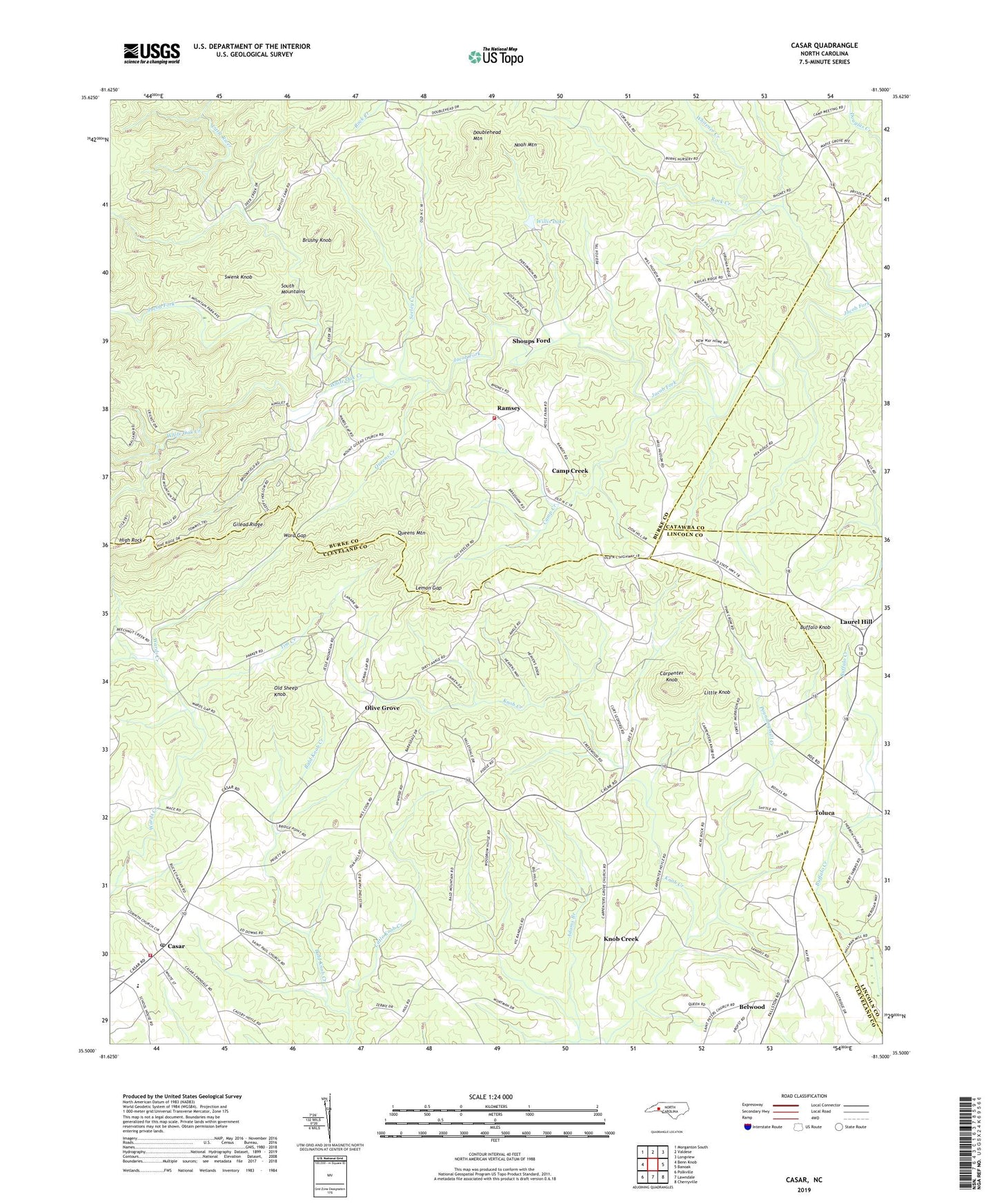
2019 topographic map quadrangle Casar in the state of North Carolina. Scale: 1:24000. Based on the newly updated USGS 7.5' US Topo map series, this map is in the following counties: Cleveland, Burke, Lincoln, Catawba. The map contains contour data, water features, and other items you are used to seeing on USGS maps, but also has updated roads and other features. This is the next generation of topographic maps. Printed on high-quality waterproof paper with UV fade-resistant inks.
Quads adjacent to this one:
West: Benn Knob
Northwest: Morganton South
North: Valdese
Northeast: Longview
East: Banoak
Southeast: Cherryville
South: Lawndale
Southwest: Polkville
Contains the following named places: Adams Branch, Bald Knob Creek, Beulah Church, Big Hill Church, Brushy Knob, Buffalo Knob, Camp Creek, Carpenter Knob, Carpenters Grove Church, Casar, Casar Elementary School, Casar Post Office, Casar Volunteer Fire Department, Doublehead Mountain, Ellis Chapel, Gilead Ridge, High Rock, Knob Creek, Knob Creek Township 10, Laurel Hill, Leman Gap, Little Knob, Little River, Maple Grove Church, Mount Gilead Church, Mull Grove, Noah Mountain, Old Sheep Knob, Olive Grove, Olive Grove Church, Peoples Church, Pine Mountain Lakes, Pisgah Church, Poundingmill Creek, Queens Creek, Queens Mountain, Ramsey, Saint Pauls Church, Saint Peters Church, Seeley Creek, Shoups Ford, South Mountains Volunteer Fire Department, Swenk Knob, Tim Creek, Toluca, Town of Casar, Township of Lower Fork, Ward Gap, White Oak Creek, Whitener Creek, Willis Lake, Willis Lake Dam, Zion Hill Church, Zoar Church