MyTopo
Benn Knob North Carolina US Topo Map
Couldn't load pickup availability
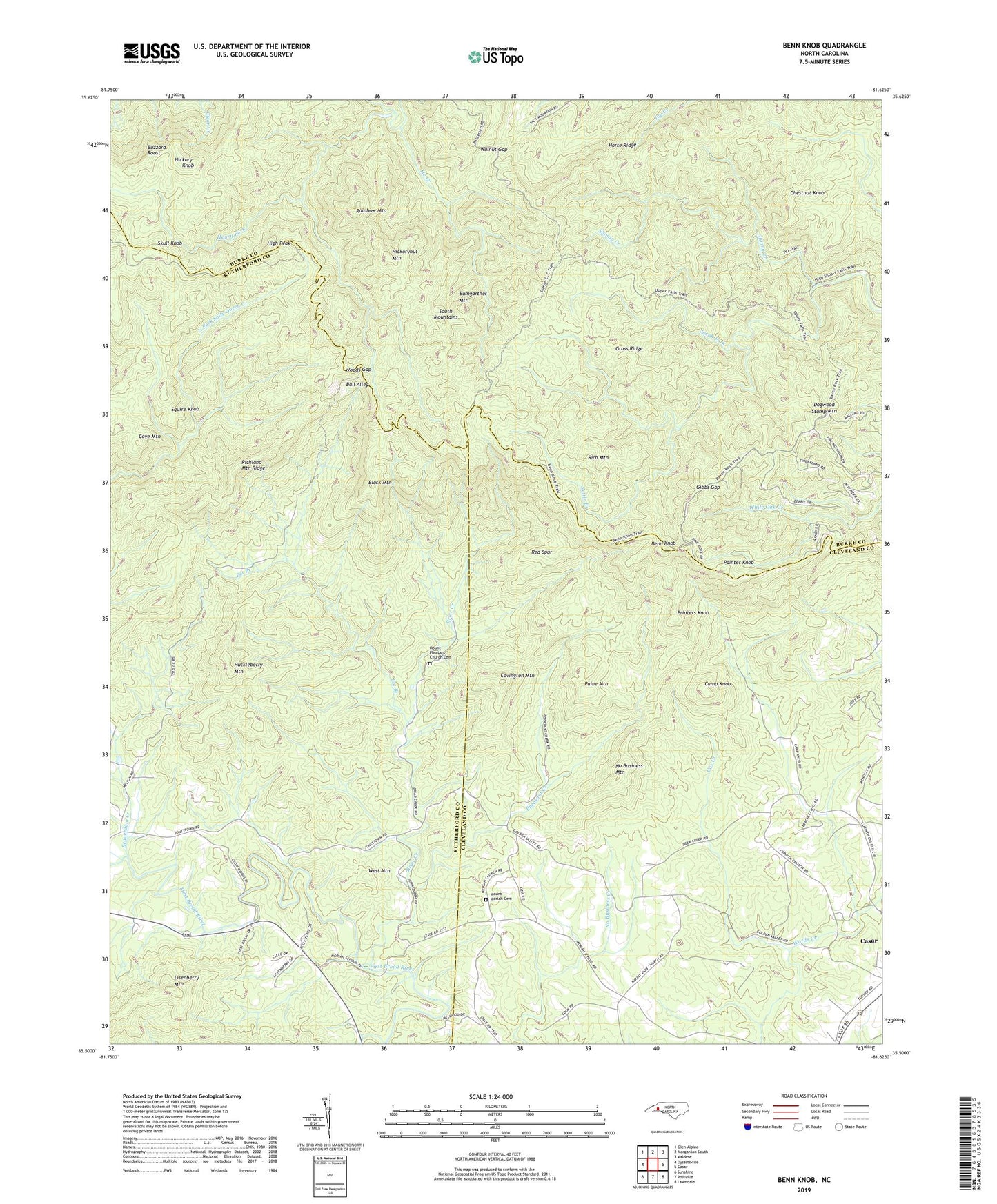
2022 topographic map quadrangle Benn Knob in the state of North Carolina. Scale: 1:24000. Based on the newly updated USGS 7.5' US Topo map series, this map is in the following counties: Cleveland, Burke, Rutherford. The map contains contour data, water features, and other items you are used to seeing on USGS maps, but also has updated roads and other features. This is the next generation of topographic maps. Printed on high-quality waterproof paper with UV fade-resistant inks.
Quads adjacent to this one:
West: Dysartsville
Northwest: Glen Alpine
North: Morganton South
Northeast: Valdese
East: Casar
Southeast: Lawndale
South: Polkville
Southwest: Sunshine
This map covers the same area as the classic USGS quad with code o35081e6.
Contains the following named places: Ball Alley, Beaverdam Creek, Benn Knob, Black Mountain, Brier Creek, Bumgarther Mountain, Buzzard Roost, Camp Knob, Casar Township 11, Chestnut Knob, Corinth Church, Cove Mountain, Covington Mountain, Cox Creek, Dogwood Stamp Mountain, Gibbs Gap, Grass Ridge, He Creek, Hickory Knob, Hickorynut Mountain, High Peak, Horse Ridge, Horse Ridge Lookout Tower, Huckleberry Mountain, Lisenberry Mountain, Morganton Watershed Dam, Morganton Watershed Lake, Moriah School, Mount Moriah Cemetery, Mount Moriah Church, Mount Pleasant Church, Mount Pleasant Church Cemetery, Nettle Branch, New Home, New Home Church, No Business Mountain, Paine Mountain, Painter Knob, Pheasant Creek, Pot Branch, Printers Knob, Rainbow Mountain, Red Spur, Rich Mountain, Richland Mountain Ridge, Shinny Creek, Skull Knob, South Mountains, South Mountains State Park, Squire Knob, Walnut Gap, West Mountain, Whiteside Mines, Woods Gap, ZIP Code: 28020