MyTopo
Castalia North Carolina US Topo Map
Couldn't load pickup availability
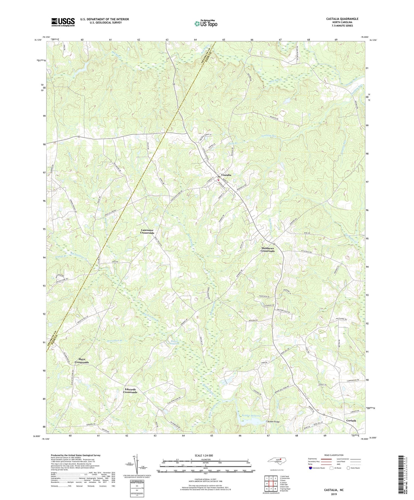
2019 topographic map quadrangle Castalia in the state of North Carolina. Scale: 1:24000. Based on the newly updated USGS 7.5' US Topo map series, this map is in the following counties: Nash, Franklin. The map contains contour data, water features, and other items you are used to seeing on USGS maps, but also has updated roads and other features. This is the next generation of topographic maps. Printed on high-quality waterproof paper with UV fade-resistant inks.
Quads adjacent to this one:
West: Justice
Northwest: Gold Sand
North: Centerville
Northeast: Essex
East: Red Oak
Southeast: Nashville
South: Spring Hope
Southwest: Bunn East
Contains the following named places: Back Swamp, Bear Creek, Beaverdam Branch, Belford, Belford Church, Bethlehem Church, Bethlehem School, Big Peachtree Creek, Boddie Bridge, Boddies Millpond, Bodies Millpond, Braswell School, Castalia, Castalia Post Office, Castalia Volunteer Fire Department, Cedar Rock Church, Corinth, Corinth Church, Edwards Crossroads, Edwards School, Griffin School, Jumping Run, Lancaster Crossroads, Little Peachtree Creek, Mars Hill School, Matthews Crossroads, Mays Crossroads, Nash County Wildlife Lake, Nash County Wildlife Lake Dam, Pleasants Pond, Pleasants Pond Dam, Red Bud Creek, Saint Delight Church, Saints Delight Church, Snowhill School, Terry Branch, Town of Castalia, Township of Castalia, Tumbling Run, Wildcat Branch, Woods Mill, ZIP Code: 27816