MyTopo
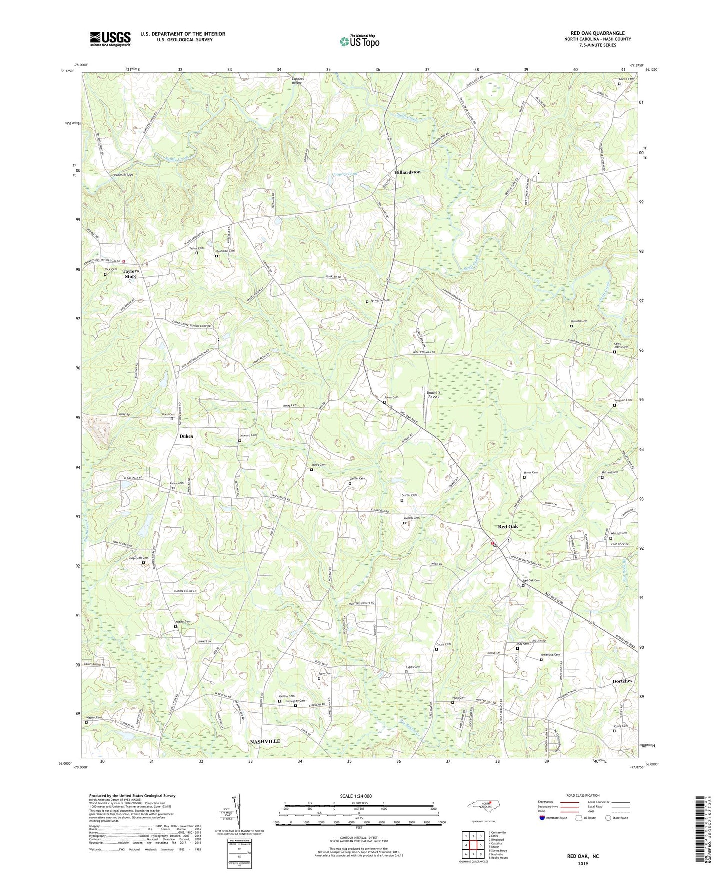
Red Oak North Carolina US Topo Map
Couldn't load pickup availability
2022 topographic map quadrangle Red Oak in the state of North Carolina. Scale: 1:24000. Based on the newly updated USGS 7.5' US Topo map series, this map is in the following counties: Nash. The map contains contour data, water features, and other items you are used to seeing on USGS maps, but also has updated roads and other features. This is the next generation of topographic maps. Printed on high-quality waterproof paper with UV fade-resistant inks.
Quads adjacent to this one:
West: Castalia
Northwest: Centerville
North: Essex
Northeast: Ringwood
East: Drake
Southeast: Rocky Mount
South: Nashville
Southwest: Spring Hope
This map covers the same area as the classic USGS quad with code o36077a8.
Contains the following named places: Adams Cemetery, Arrington Cemetery, Beulah Church, Boseman Cemetery, Capps Cemetery, Castalia Volunteer Fire Department, Cedar Grove School, Coley Cemetery, Collins Pond, Collins Pond Dam, Coopers Bridge, Coopers Pond, Coopers Pond Dam, Cyrus Store, Double S Airport, Drakes Bridge, Dukes, Ellens Store, Enroughty Cemetery, Evans School, Gideon Swamp, Green Cemetery, Griffin Cemetery, Grossetts Store, Hales Cemetery, Hedgepeth Cemetery, Hillardston School, Hilliard Cemetery, Hilliards Store, Hilliardston, Hunt Cemetery, Jones Cemetery, Leonard Cemetery, May Cemetery, Philadelphia Church, Philadelphia School, Red Oak, Red Oak Cemetery, Red Oak District Volunteer Fire Department, Red Oak Elementary School, Red Oak Post Office, Redland School, Rose Cemetery, Saint Delight Church, Saint Johns Cemetery, Saint Johns Church, Sandy Creek, Social Union Church, Suttons Store, Swift Creek School, Taylor Cemetery, Taylors School, Taylors Store, Town of Red Oak, Township of Griffins, Township of Red Oak, Vaughan Cemetery, Vick Cemetery, Walker Cemetery, Wards Store, Whitfield Cemetery, Whitley Cemetery, Wood Cemetery, York Chapel, ZIP Code: 27856