MyTopo
Essex North Carolina US Topo Map
Couldn't load pickup availability
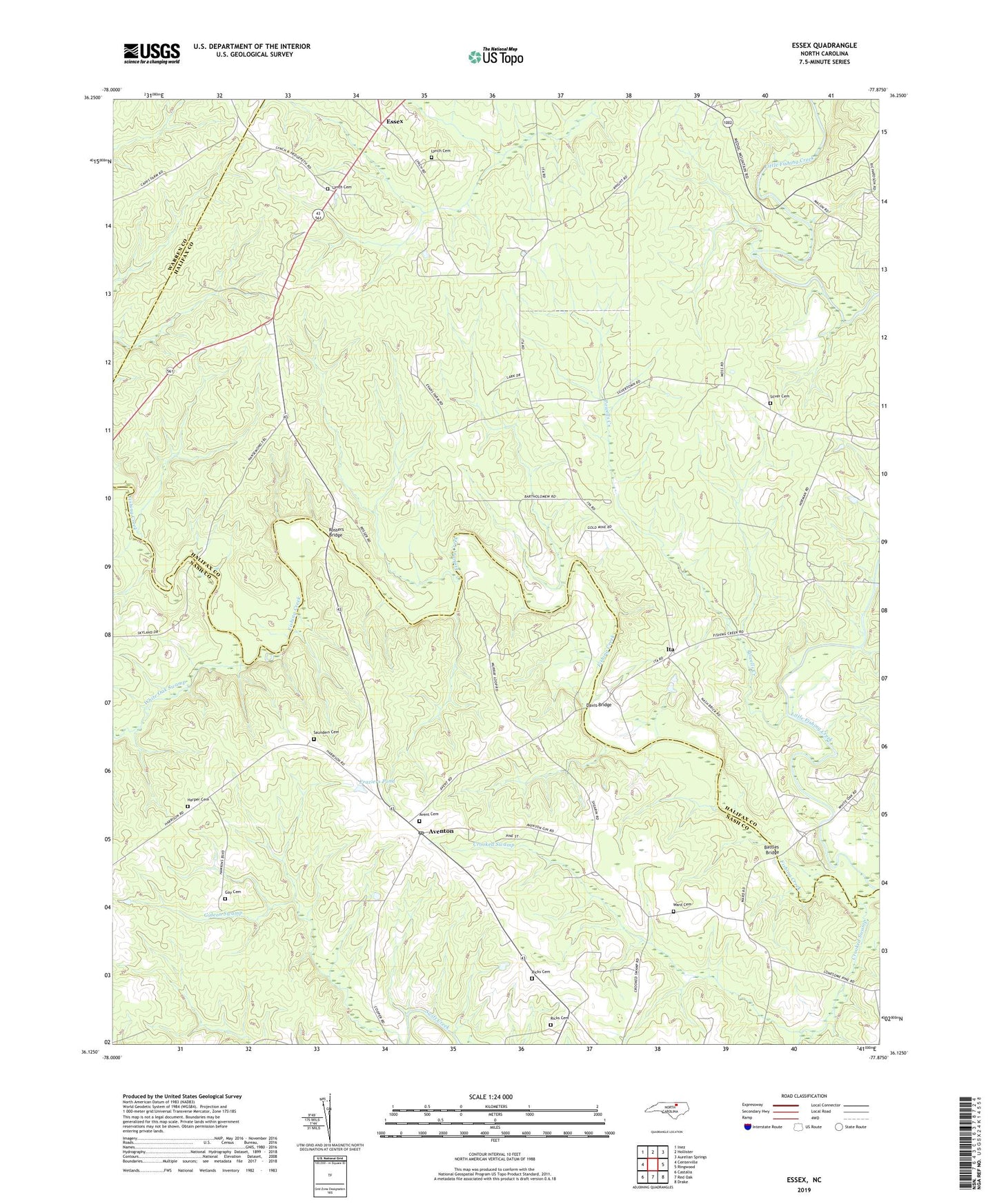
2022 topographic map quadrangle Essex in the state of North Carolina. Scale: 1:24000. Based on the newly updated USGS 7.5' US Topo map series, this map is in the following counties: Halifax, Nash, Warren. The map contains contour data, water features, and other items you are used to seeing on USGS maps, but also has updated roads and other features. This is the next generation of topographic maps. Printed on high-quality waterproof paper with UV fade-resistant inks.
Quads adjacent to this one:
West: Centerville
Northwest: Inez
North: Hollister
Northeast: Aurelian Springs
East: Ringwood
Southeast: Drake
South: Red Oak
Southwest: Castalia
This map covers the same area as the classic USGS quad with code o36077b8.
Contains the following named places: Avent Cemetery, Aventon, Aventon Post Office, Aventon School, Battles Bridge, Bluff Loop Trail, Crooked Swamp, Davis Bridge, Doziers Lake, Doziers Lake Dam, Essex, Fishing Creek Church, Fraziers Pond, Fraziers Pond Dam, Gay Cemetery, Harmony Church, Harper Cemetery, Hollister Volunteer Rescue Squad, Ita, Little Fishing Creek, Lynch Cemetery, Medoc Mountain State Park Office, Perry Grove Church, Pleasant Grove Church, Pleasure Hill Church, Powells Creek, Ricks Cemetery, Ricks Pond, Ricks Pond Dam, Rossers Bridge, Saunders Cemetery, Silver Cemetery, Stream Loop Trail, Township of Brinkleyville, Walters Chapel, Ward Cemetery, Wards Store, White Oak Swamp, WVSP-FM (Warrenton), ZIP Code: 27844