MyTopo
Cedar Creek North Carolina US Topo Map
Couldn't load pickup availability
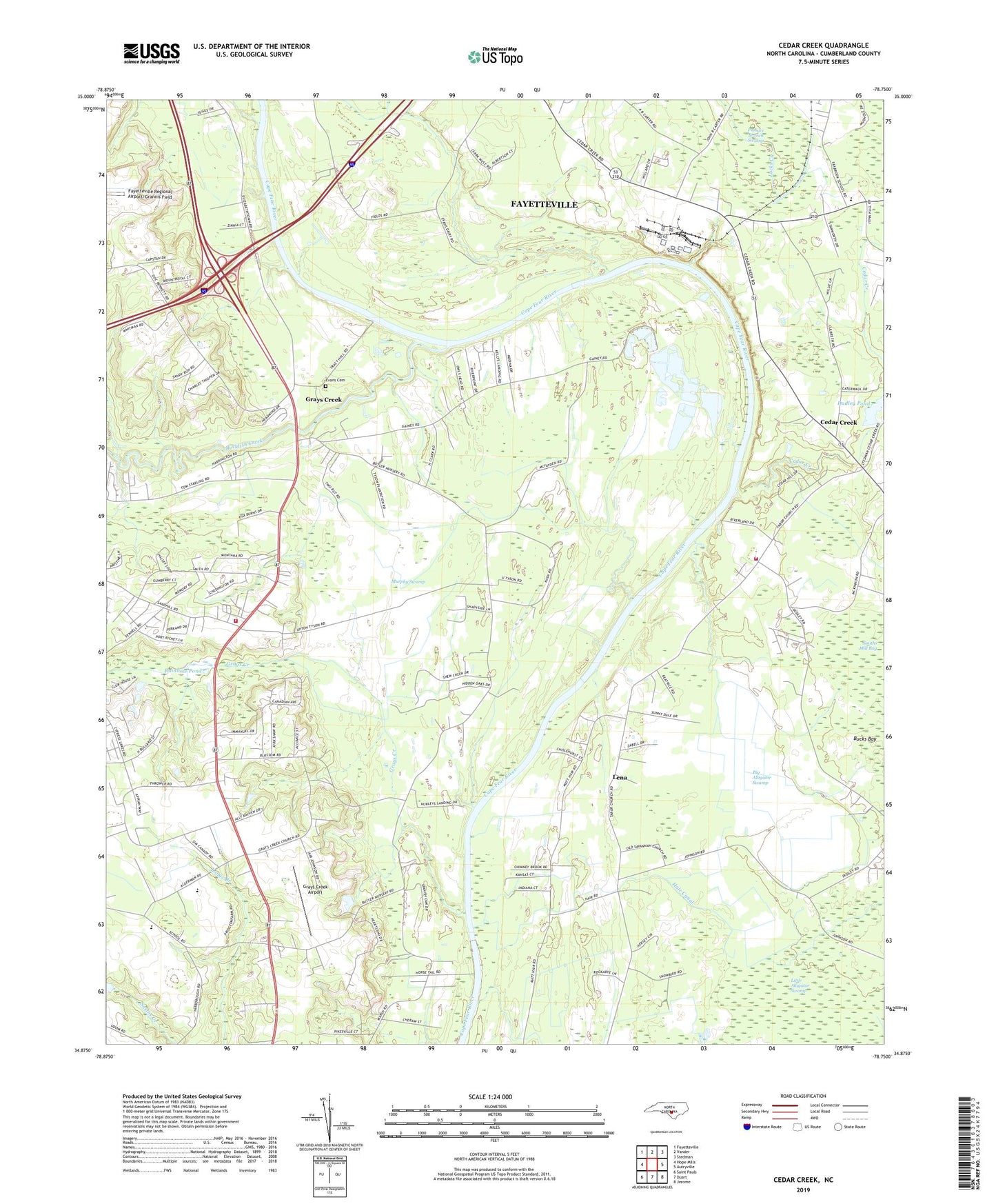
2022 topographic map quadrangle Cedar Creek in the state of North Carolina. Scale: 1:24000. Based on the newly updated USGS 7.5' US Topo map series, this map is in the following counties: Cumberland. The map contains contour data, water features, and other items you are used to seeing on USGS maps, but also has updated roads and other features. This is the next generation of topographic maps. Printed on high-quality waterproof paper with UV fade-resistant inks.
Quads adjacent to this one:
West: Hope Mills
Northwest: Fayetteville
North: Vander
Northeast: Stedman
East: Autryville
Southeast: Jerome
South: Duart
Southwest: Saint Pauls
This map covers the same area as the classic USGS quad with code o34078h7.
Contains the following named places: Bethlehem Church, Big Alligator Swamp, Big Sandy Run, Cape Fear Church, Cedar Creek, Cedar Creek Church, Cedar Creek Fire Department, Cumberland Church, Dudley Pond, Dudley Pond Dam, Evans Cemetery, Falling Run Church, Grays Creek, Grays Creek Airport, Grays Creek Church, Grays Creek Community Center, Grays Creek Elementary School, Grays Creek Fire Department Station 24, Hair Canal, House of Prayer, Lena, Marvin Church, McNeill Pond, Mount Calvary Church, Mount Pisgah Church, Murphy Swamp, Pasture Branch Swamp, Rainbow Pond, Rainbow Pond Dam, Rockfish Creek, Savannah Church, Seabrook School, Sherwood Church, Tabor Church, Township of Grays Creek