MyTopo
Hertford North Carolina US Topo Map
Couldn't load pickup availability
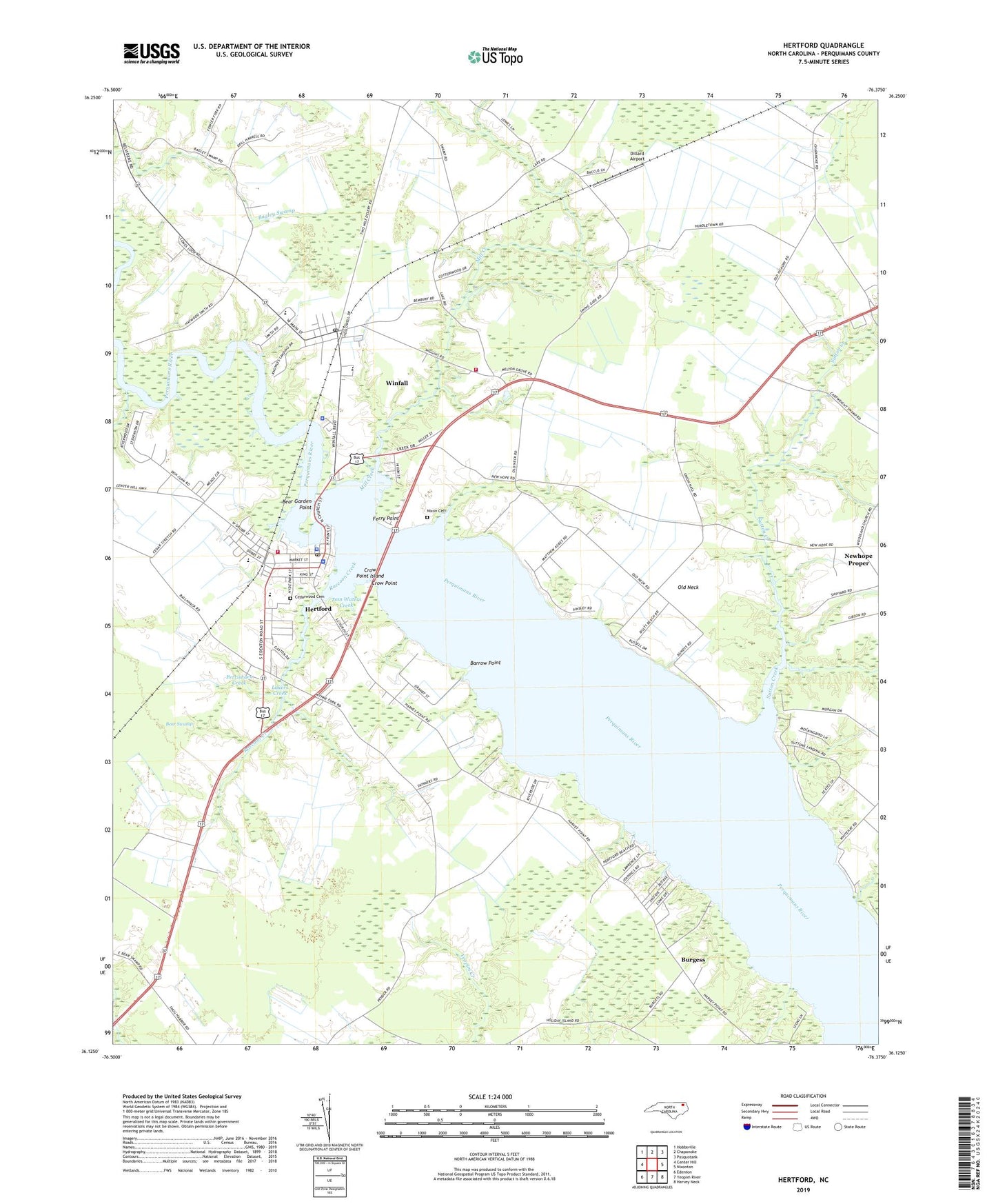
2022 topographic map quadrangle Hertford in the state of North Carolina. Scale: 1:24000. Based on the newly updated USGS 7.5' US Topo map series, this map is in the following counties: Perquimans. The map contains contour data, water features, and other items you are used to seeing on USGS maps, but also has updated roads and other features. This is the next generation of topographic maps. Printed on high-quality waterproof paper with UV fade-resistant inks.
Quads adjacent to this one:
West: Center Hill
Northwest: Hobbsville
North: Chapanoke
Northeast: Pasquotank
East: Nixonton
Southeast: Harvey Neck
South: Yeopim River
Southwest: Edenton
This map covers the same area as the classic USGS quad with code o36076b4.
Contains the following named places: Bagley Swamp Church, Bagleys Chapel Baptist Church, Barrow Point, Bear Garden Point, Bear Swamp, Bethlehem Church, Brian Center Health and Rehabilitation of Hertford, Burgess, Cedar Grove Church, Cedarwood Cemetery, Central School, Church of the Holy Trinity, County Union School, Crow Point, Crow Point Island, Dillard Airport, Emmanuel Church, Ferry Point, First Baptist Church of Hertford, First Gospel Tabernacle, Forestburg, Harris Shopping Center, Hertford, Hertford Baptist Church, Hertford Beach, Hertford Fire Department, Hertford Grammer School, Hertford Police Department, Hertford Post Office, Hertford United Methodist Church, Hertford Wastewater Treatment Plant, Holiness Church, Holy Trinity Episcopal Church, Jennies Gut, Lakers Creek, Light Nixon Fork, Love Fellowship Church, Melton Grove Church, Mill Creek, Mount Sinai Church, Municipal Building, Newbold-White, Newhope Proper, Nixon Cemetery, Oak Hill Church, Old Neck, Perquimans Central School, Perquimans County, Perquimans County Courthouse, Perquimans County High School, Perquimans County Rescue and Emergency Medical Services, Perquimans County Sheriff's Office, Perrishoes Creek, Pleasant Grove Church, Poplar Run Church, Raccoon Creek, Saint Pauls Church, Smithtown, Southern Shores, Sutton Creek, Tom Waters Creek, Toms Creek, Town of Hertford, Town of Winfall, Township of Parkville, White Hat Landing, Winfall, Winfall Police Department, Winfall Post Office, Winfall Volunteer Fire Department, Wynne Fork Housing Development, ZIP Codes: 27944, 27985