MyTopo
Cool Springs North Carolina US Topo Map
Couldn't load pickup availability
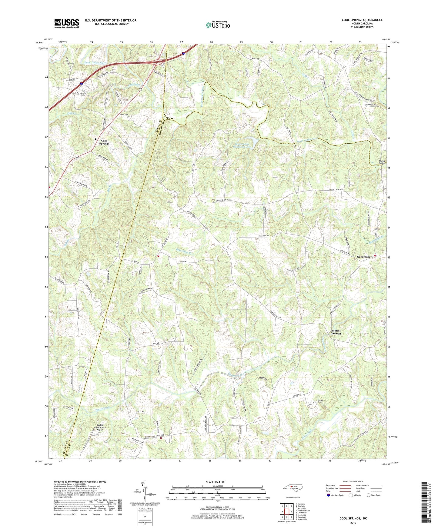
2022 topographic map quadrangle Cool Springs in the state of North Carolina. Scale: 1:24000. Based on the newly updated USGS 7.5' US Topo map series, this map is in the following counties: Rowan, Iredell, Davie. The map contains contour data, water features, and other items you are used to seeing on USGS maps, but also has updated roads and other features. This is the next generation of topographic maps. Printed on high-quality waterproof paper with UV fade-resistant inks.
Quads adjacent to this one:
West: Statesville East
Northwest: Harmony
North: Calahaln
Northeast: Mocksville
East: Cooleemee
Southeast: Rowan Mills
South: Cleveland
Southwest: Shepherds
This map covers the same area as the classic USGS quad with code o35080g6.
Contains the following named places: Bell Branch, Byerlys Chapel Methodist, Cleveland Community Volunteer Fire Department Station 35, Cool Spring School, Cool Springs, Cool Springs Volunteer Fire Department Station 2, Davie Academy Corners, Dusty Road Jersey Farm, Fifth Creek, Flying S Ranch Airport, Knox Grove Church, Little Creek, Moores Chapel, Mount Vernon, Needmore, New Jerusalem Church, Pittsburg, Providence Church, Rowan - Iredell Volunteer Fire Department, Scotch - Irish Volunteer Fire Department Station 73, Scotch-Irish Plantation Lake, Scotch-Irish Plantation Lake Dam, Shaws Bridge, South River Church, Strouds Store site, Third Creek Church, Township of Scotch Irish, Unity, ZIP Code: 27013