MyTopo
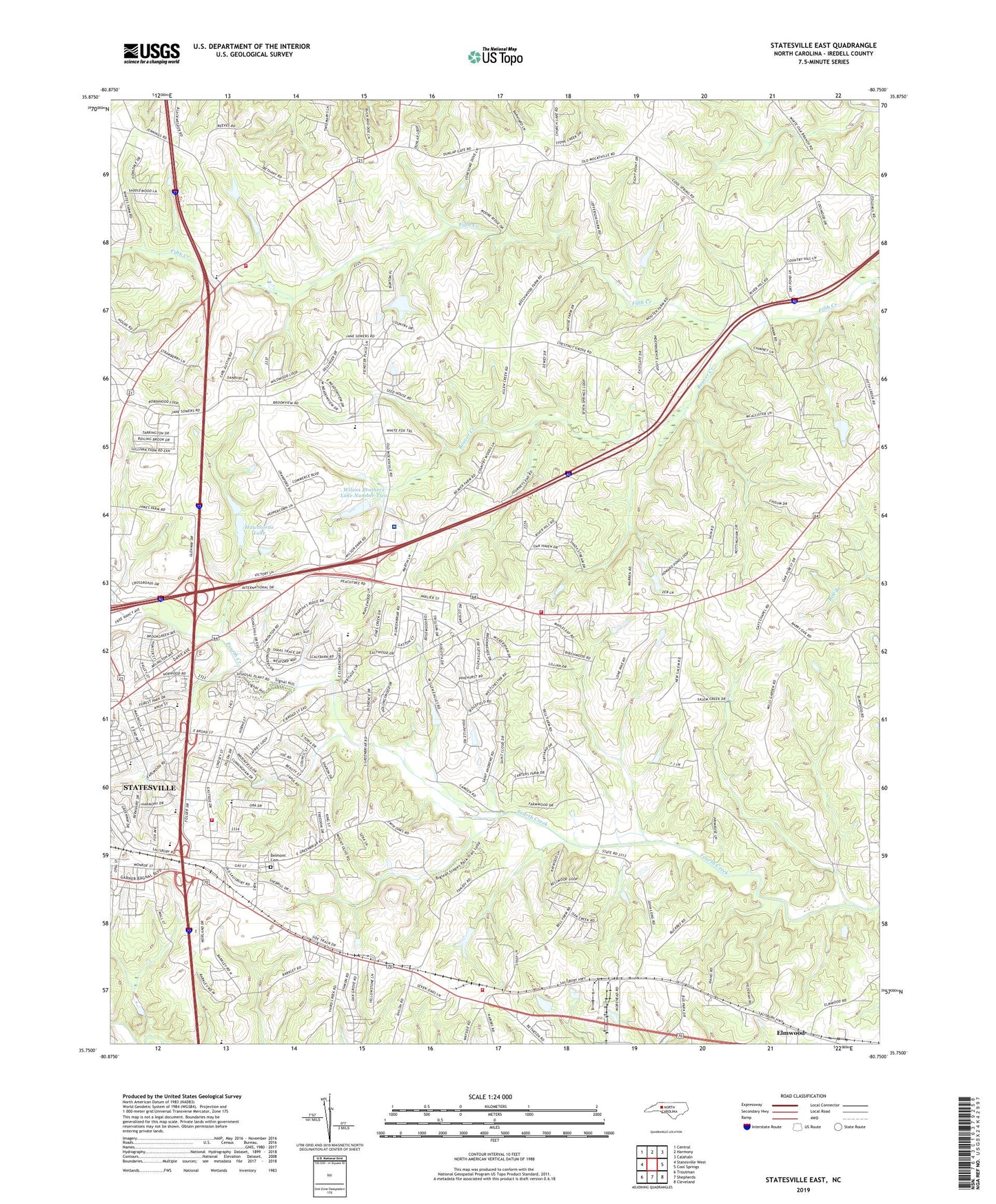
Statesville East North Carolina US Topo Map
Couldn't load pickup availability
2022 topographic map quadrangle Statesville East in the state of North Carolina. Scale: 1:24000. Based on the newly updated USGS 7.5' US Topo map series, this map is in the following counties: Iredell. The map contains contour data, water features, and other items you are used to seeing on USGS maps, but also has updated roads and other features. This is the next generation of topographic maps. Printed on high-quality waterproof paper with UV fade-resistant inks.
Quads adjacent to this one:
West: Statesville West
Northwest: Central
North: Harmony
Northeast: Calahaln
East: Cool Springs
Southeast: Cleveland
South: Shepherds
Southwest: Troutman
This map covers the same area as the classic USGS quad with code o35080g7.
Contains the following named places: Abilene Church, Baymount Meadows, Beaver Creek, Bellwood, Belmont, Belmont Cemetery, Berkshire Hills, Bethany Church, Broadview, Brookdale Lake Dam, Brookgreen, Brookmeade, Brookwood School, Camelot Acres, Cameron Church, Cedar Hills, Chapel Hill Church, Chestnut Grove Church, Christ Church, City of Statesville, Clark Plant, Cloaninger, Cool Springs Volunteer Fire Department Station 1, Covenant Church, Crawford Dam, Dal-Wan Heights, Danbury Forest, Davidson Church, Davis Regional Medical Center, East Brook, East Iredell School, Eastfield Estates, Eastover Acres, Eastside, Ebenezer School, Ebenezer Volunteer Fire Department, Elmwood, Elmwood Quarry, Faith Church, Fifth Creek Church, Forest Park Church, Fourth Creek Sewage Treatment Plant, Freedom Church, Gays Chapel, Glenn Echo, Green Acres, Hatfield Association Lake, Hatfield Association Lake Dam, Hawthorne Dam Lower, Hawthorne Dam Upper, Hawthorne Lake, Ian Joy Acres, Iredell County, Iredell Heights, Martin Dam, Matthew, Meadow View, Mitchell Aire, Nelly Green Estates, New Salem Church, Newtowne Mall, Noname, Oak Grove Church, Oakdale Church, Oakwood Junior High School, Old Farm, Ourdell, Pressly School, Providence Church, Rose Chapel, Shannon Acres, Sherwood Forest, Signal Hill Shopping Center, Statesville Country Club, Statesville Fire Department Station 3, Statesville Flour Mill Dam, Township of Bethany, Township of Chambersburg, Township of Cool Springs, Twin Oaks Golf Course, Unity High School, Valley Stream, Vance, Wayside School, Wayside Volunteer Fire Department, WDRV-AM (Statesville), Wildwood Park, William L Walker Dam, Williams Grove Church, Wilson Brothers Dam Number One, Wilson Brothers Dam Number Two, Wilson Brothers Lake Number One, Wilson Brothers Lake Number Two, Zion Church