MyTopo
Columbia West North Carolina US Topo Map
Couldn't load pickup availability
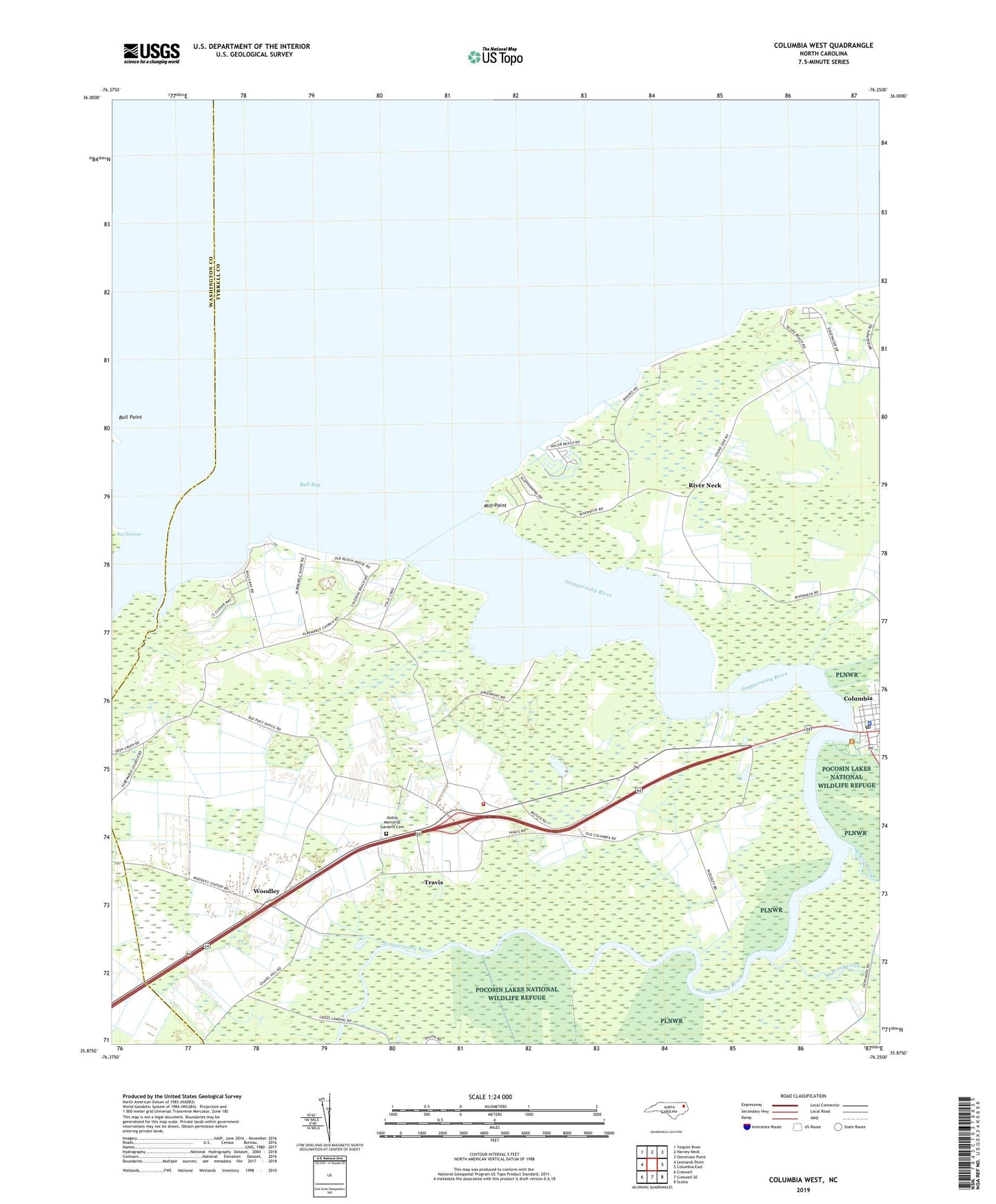
2019 topographic map quadrangle Columbia West in the state of North Carolina. Scale: 1:24000. Based on the newly updated USGS 7.5' US Topo map series, this map is in the following counties: Tyrrell, Washington. The map contains contour data, water features, and other items you are used to seeing on USGS maps, but also has updated roads and other features. This is the next generation of topographic maps. Printed on high-quality waterproof paper with UV fade-resistant inks.
Quads adjacent to this one:
West: Leonards Point
Northwest: Yeopim River
North: Harvey Neck
Northeast: Stevenson Point
East: Columbia East
Southeast: Scotia
South: Creswell SE
Southwest: Creswell
Contains the following named places: Azalia Memorial Gardens Cemetery, Back Landing, Bay, Bull Bay, Bull Point, Bunton Creek, Chapel Hill Missionary Church, Colonial Beach, Columbia, Columbia Police Department, Columbia Post Office, Cross Landing, Dunbars Landing, Grinnell Hill, Mill Point, New Jerusalem Church, New Run, Norman Smith Legion Beach, North Carolina State Highway Patrol, Piney Marsh, Riders Creek, River Neck, River Neck Landing, Salem Baptist Church, Scuppernong Fire Department Station 5, Scuppernong River, Second Creek, Simmons Landing, Tideland Mental Health Center of Columbia, Township of Scuppernong, Travis, Tyrrell County Library, Tyrrell County Sheriff's Office, Wesley Memorial United Methodist Church, Woodley, WUND-TV (Columbia)