
MyTopo
Creswell North Carolina US Topo Map
Couldn't load pickup availability
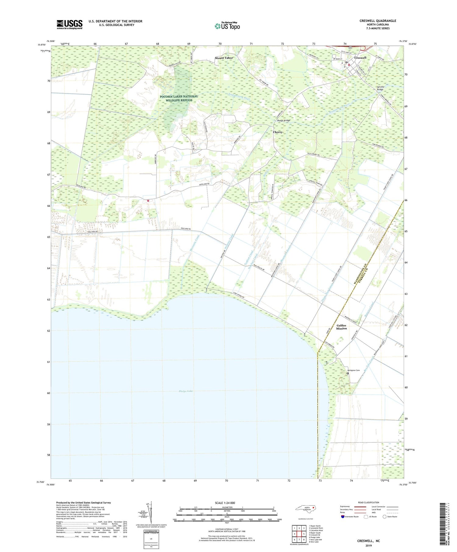
2019 topographic map quadrangle Creswell in the state of North Carolina. Scale: 1:24000. Based on the newly updated USGS 7.5' US Topo map series, this map is in the following counties: Washington, Tyrrell. The map contains contour data, water features, and other items you are used to seeing on USGS maps, but also has updated roads and other features. This is the next generation of topographic maps. Printed on high-quality waterproof paper with UV fade-resistant inks.
Quads adjacent to this one:
West: Roper South
Northwest: Roper North
North: Leonards Point
Northeast: Columbia West
East: Creswell SE
Southeast: New Lake
South: New Lake NW
Southwest: Pungo Lake
Contains the following named places: Bee Tree Overlook, Bonarva Canal, Cherry, Cherry Church of God, Concord Church, Creswell, Creswell Elementary School, Creswell High School, Creswell Methodist Church, Creswell Post Office, Creswell Volunteer Fire Department, Galilee Mission, Lake Phelps Volunteer Fire Department, Mall Creek, Moccasin Canal, Mount Hermon Church, Mount Tabor, Mount Tabor Church, Mountain Canal, New Lands, Ninefoot Canal, Pettigrew Cemetery, Pettigrew State Park, Pettigrow State Park Information Center, Pettigrow State Park Office, Phelps Bridge, Phelps Lake, Philippi Church, Saint Davids Church, Saint Marys Church, Somerset Place State Historical Site, Spruills Bridge, Tenfoot Canal, Thirty-Foot Canal, Town of Creswell, Township of Scuppernong, Western Canal, Woodley Chapel, ZIP Code: 27928


