
MyTopo
Currituck North Carolina US Topo Map
Couldn't load pickup availability
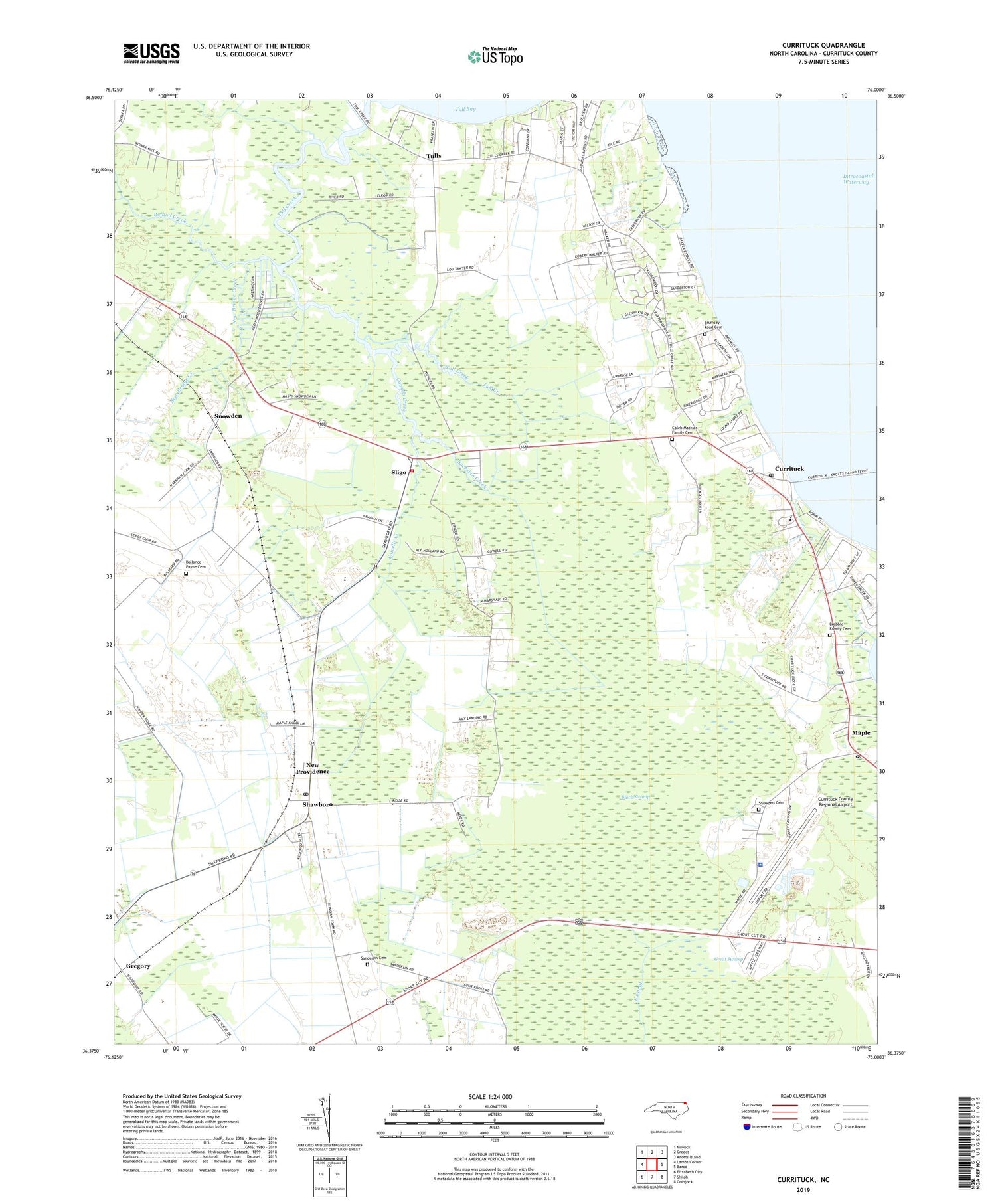
2019 topographic map quadrangle Currituck in the state of North Carolina. Scale: 1:24000. Based on the newly updated USGS 7.5' US Topo map series, this map is in the following counties: Currituck. The map contains contour data, water features, and other items you are used to seeing on USGS maps, but also has updated roads and other features. This is the next generation of topographic maps. Printed on high-quality waterproof paper with UV fade-resistant inks.
Quads adjacent to this one:
West: Lambs Corner
Northwest: Moyock
North: Creeds
Northeast: Knotts Island
East: Barco
Southeast: Coinjock
South: Shiloh
Southwest: Elizabeth City
Contains the following named places: Ballance - Payne Cemetery, Beechwood Shores, Brabble Family Cemetery, Brumsey Road Cemetery, Buckskin Creek, Caleb Mathias Family Cemetery, Central Elementary School, Corner Gum, Cowells Creek, Crawford Volunteer Fire Company, Currituck, Currituck County Emergency Medical Services, Currituck County Regional Airport, Currituck County Schools Administrative Office, Currituck County Sheriff's Office, Currituck County Water Treatment Plant, Currituck Post Office, East Gab Court House, Ferebee Landing Strip, Good Hope Zion Church, Gregory, Indian Ridge, J P Knapp Junior High School, Maple, Maple Post Office, New Bridge Creek, New Providence, New Providence Church, North Carolina State Highway Patrol Troop A District 1 Substation, Perkins United Church, Plymoor Memorial Church, Providence Church, Rehoboth Church, Roland Creek, Samuel Chapel, Sanderlin Cemetery, Shawboro, Shawboro Post Office, Sligo, Snowden, Snowden Cemetery, Suburban Mobile Home Park, Township of Crawford, Tull Creek, Tulls, Wedgewood Lakes, Weeping Mary Church, ZIP Code: 27956


