MyTopo
Moyock North Carolina US Topo Map
Couldn't load pickup availability
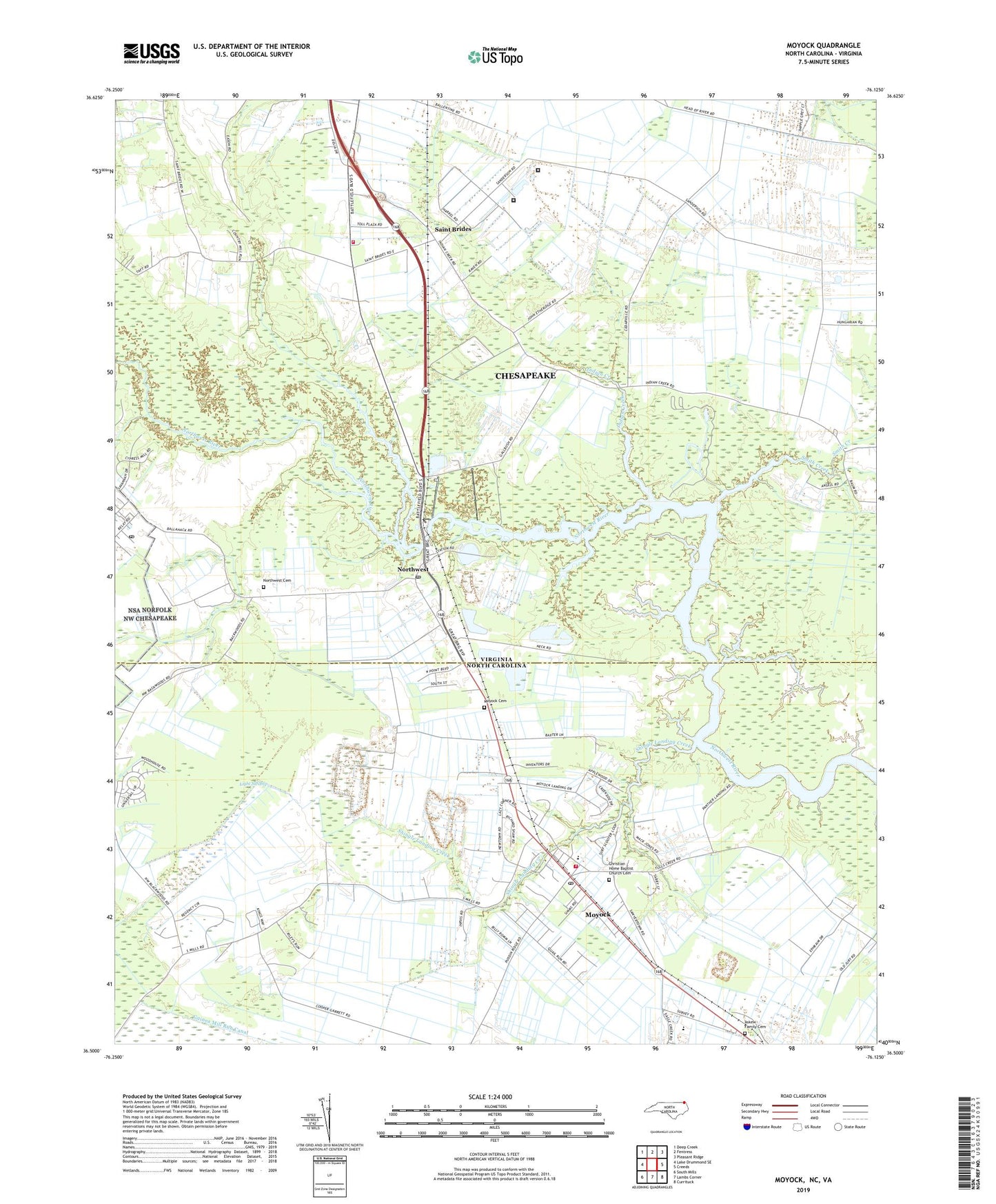
2022 topographic map quadrangle Moyock in the states of Virginia, North Carolina. Scale: 1:24000. Based on the newly updated USGS 7.5' US Topo map series, this map is in the following counties: Currituck, Chesapeake (city). The map contains contour data, water features, and other items you are used to seeing on USGS maps, but also has updated roads and other features. This is the next generation of topographic maps. Printed on high-quality waterproof paper with UV fade-resistant inks.
Quads adjacent to this one:
West: Lake Drummond SE
Northwest: Deep Creek
North: Fentress
Northeast: Pleasant Ridge
East: Creeds
Southeast: Currituck
South: Lambs Corner
Southwest: South Mills
Contains the following named places: Arringdale, Askew Family Cemetery, Carolina Village Mobile Home Park, Chesapeake Fire Department Station 7 Saint Brides, Christian Home Baptist Church Cemetery, Currituck County Fire and Emergency Medical Services Station 3 Moyock, Indian Creek, Indian Creek Church, Indian Creek Correctional Center, Light Swamp, Middlewoods Mobile Home Park, Morse, Moyock, Moyock Cemetery, Moyock Census Designated Place, Moyock Elementary School, Moyock Fire Department and Rescue Squad, Moyock Middle School, Moyock Post Office, Northwest, Northwest Cemetery, Northwest Church, Northwest Post Office, Northwest Radio Post Office, Northwest River Marsh Wildlife Area, Northwest River Park, Panther Landing, Pleasant Grove Church, Providence Swamp, Saint Brides, Saint Brides Correctional Center, Shingle Landing Creek, Smith Creek, Township of Moyock, Virginia Department of Correctional Education - Indian Creek Correctional Center, Virginia Department of Correctional Education - Saint Brides Correctional Center, Willow Grove Church, ZIP Code: 23322