MyTopo
Dobson North Carolina US Topo Map
Couldn't load pickup availability
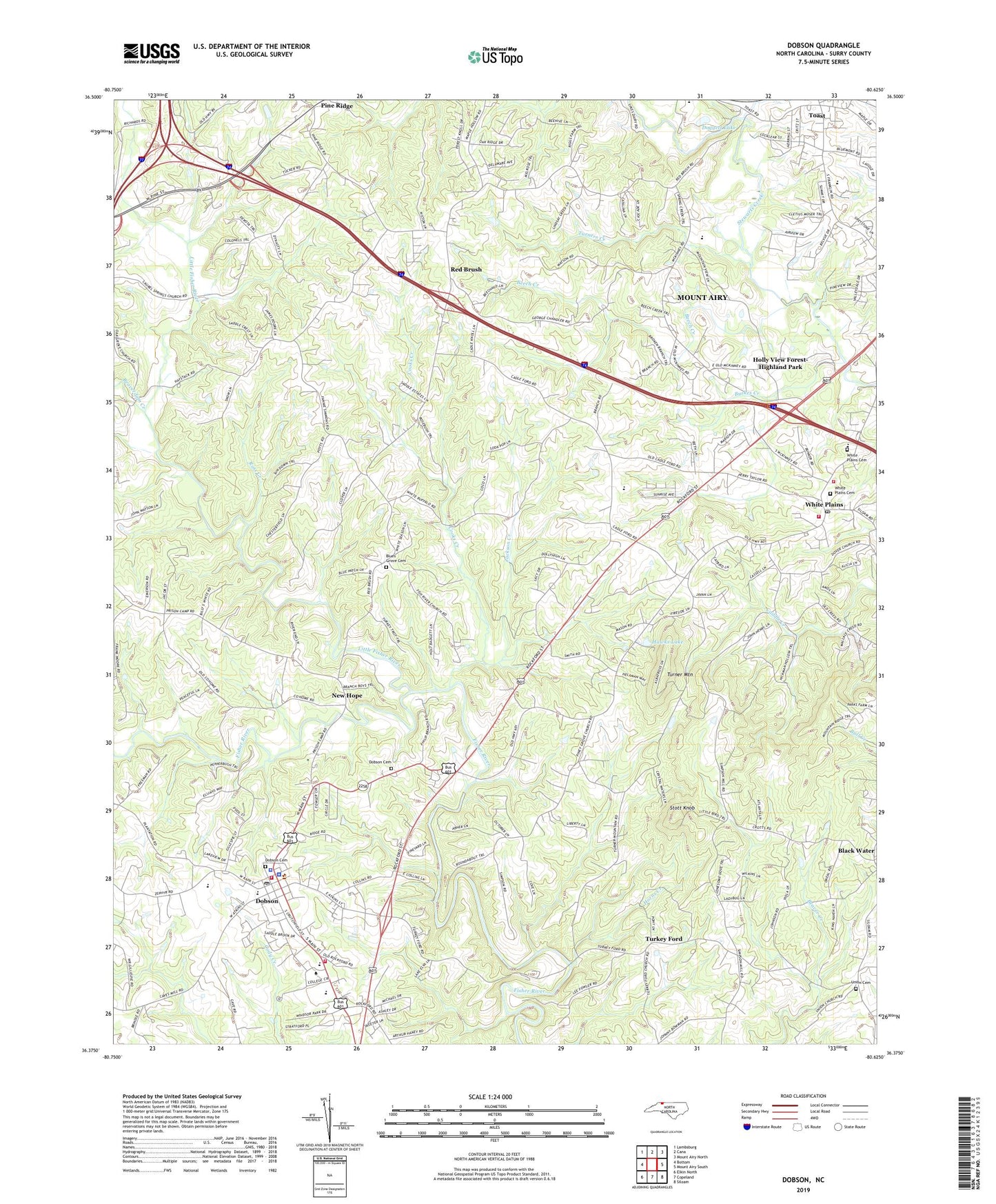
2019 topographic map quadrangle Dobson in the state of North Carolina. Scale: 1:24000. Based on the newly updated USGS 7.5' US Topo map series, this map is in the following counties: Surry. The map contains contour data, water features, and other items you are used to seeing on USGS maps, but also has updated roads and other features. This is the next generation of topographic maps. Printed on high-quality waterproof paper with UV fade-resistant inks.
Quads adjacent to this one:
West: Bottom
Northwest: Lambsburg
North: Cana
Northeast: Mount Airy North
East: Mount Airy South
Southeast: Siloam
South: Copeland
Southwest: Elkin North
Contains the following named places: Beaverdam Creek, Beech Creek, Black Water Church, Blues Grove Baptist Church, Blues Grove Cemetery, Bunker Homesite, Burkes Creek, Central Surry Volunteer Fire Department, Community Church, Cooks Creek, Dobson, Dobson Cemetery, Dobson Church, Dobson Elementary School, Dobson Fire Department, Dobson High School, Dobson Police Department, Dobson Post Office, Dobson Rescue Squad, Doggett Lake, Doggett Lake Dam, Dover Church, Emmanuel Church, Fishers River Primitive Baptist Church, Franklin, Franklin Elementary School, Hawks Lake, Hawks Lake Dam, Holly View Forest-Highland Park, Horns Creek, Jackson Creek, Laurel Springs Primitive Baptist Church, Little Fisher River, New Hope, Pickshin Nature Center, Pine Ridge, Piney Grove Baptist Church, Red Brush, Reeves-Freeman House, Ring Creek, Ross Creek, Stott Knob, Surry Central High School, Surry County, Surry County Community College, Surry County Courthouse, Surry County EMS, Surry County Sheriff's Office, Toast Census Designated Place, Town of Dobson, Township of Dobson, Turkey Ford, Turkey Ford Baptist Church, Turner Mountain, Turners Creek, Union Cemetery, Union Hill Church, Union Primitive Baptist Church, White Plains, White Plains Baptist Church, White Plains Baptist Church Cemetery, White Plains Census Designated Place, White Plains Christian Academy, White Plains Elementary School, White Plains Friends Meeting Cemetery, White Plains Friends Meeting House, White Plains High School, White Plains Post Office, White Plains Volunteer Fire Department, WYZD-AM (Dobson), ZIP Code: 27030