MyTopo
Erwin North Carolina US Topo Map
Couldn't load pickup availability
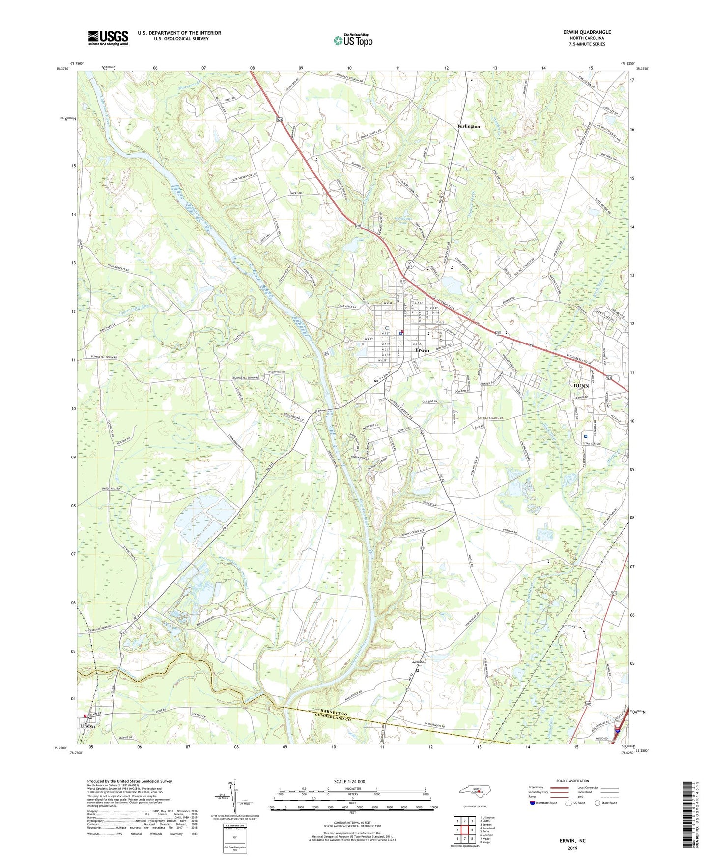
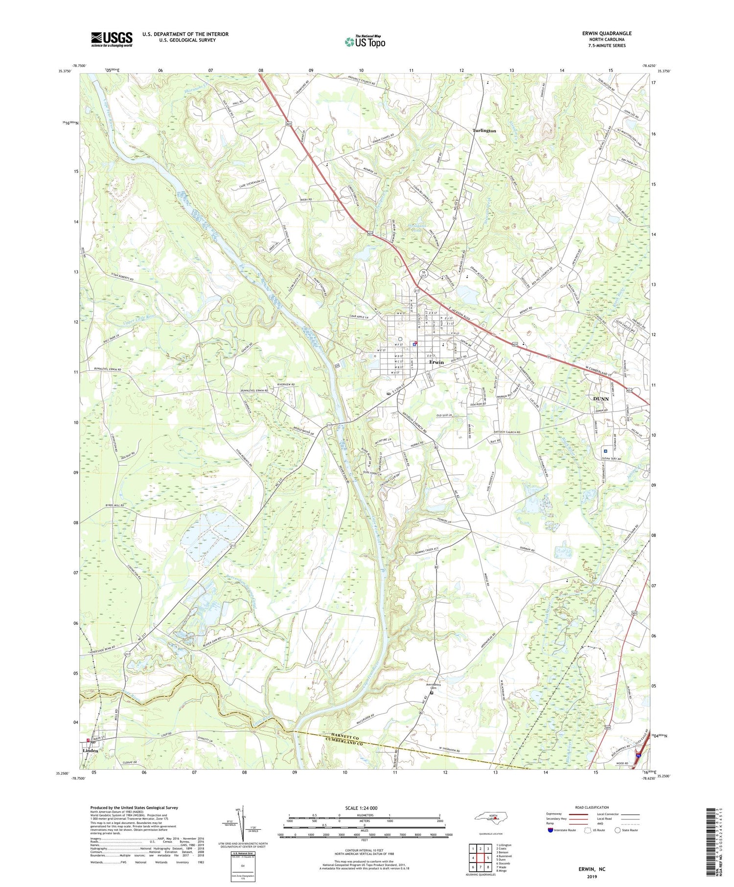
2019 topographic map quadrangle Erwin in the state of North Carolina. Scale: 1:24000. Based on the newly updated USGS 7.5' US Topo map series, this map is in the following counties: Harnett, Cumberland. The map contains contour data, water features, and other items you are used to seeing on USGS maps, but also has updated roads and other features. This is the next generation of topographic maps. Printed on high-quality waterproof paper with UV fade-resistant inks.
Quads adjacent to this one:
West: Bunnlevel
Northwest: Lillington
North: Coats
Northeast: Benson
East: Dunn
Southeast: Mingo
South: Wade
Southwest: Slocomb
Contains the following named places: Averasboro Cemetery, Beaverdam Swamp Canal, Bethel Church, Betsy Johnson Regional Hospital, Cape Fear Academy, East Erwin Baptist Church, Erwin, Erwin Airport, Erwin Chapel, Erwin Church of God, Erwin Fire Department and Rescue Squad, Erwin Middle, Erwin Police Department, Erwin Post Office, Erwin Presbyterian Church, Erwin United Methodist Church, First Baptist Church of Erwin, First Free Will Baptist Church, Gentry Primary School, Good Hope Hospital, Harnett Crossings Shopping Center, Jernigans Pond, Jernigans Pond Dam, Johnson Memorial Church, Juniper Creek, Linden, Linden Post Office, Little River, Oak Grove Church, Pleasant Grove Church, Porters Chapel, Saint Stephens Episcopal Church, Sansom Chapel, Smith Grove Church, Stewart Creek, Thorntons Creek, Town of Erwin, Town of Linden, Township of Duke, Triton High School, Turlington, Turlington Grove Church, Upper Little River, Walkers Chapel, West M Street Pentecostal Church, Westarea Fire Department - Station 20, Westfield Baptist Church, ZIP Code: 28339