MyTopo
Slocomb North Carolina US Topo Map
Couldn't load pickup availability
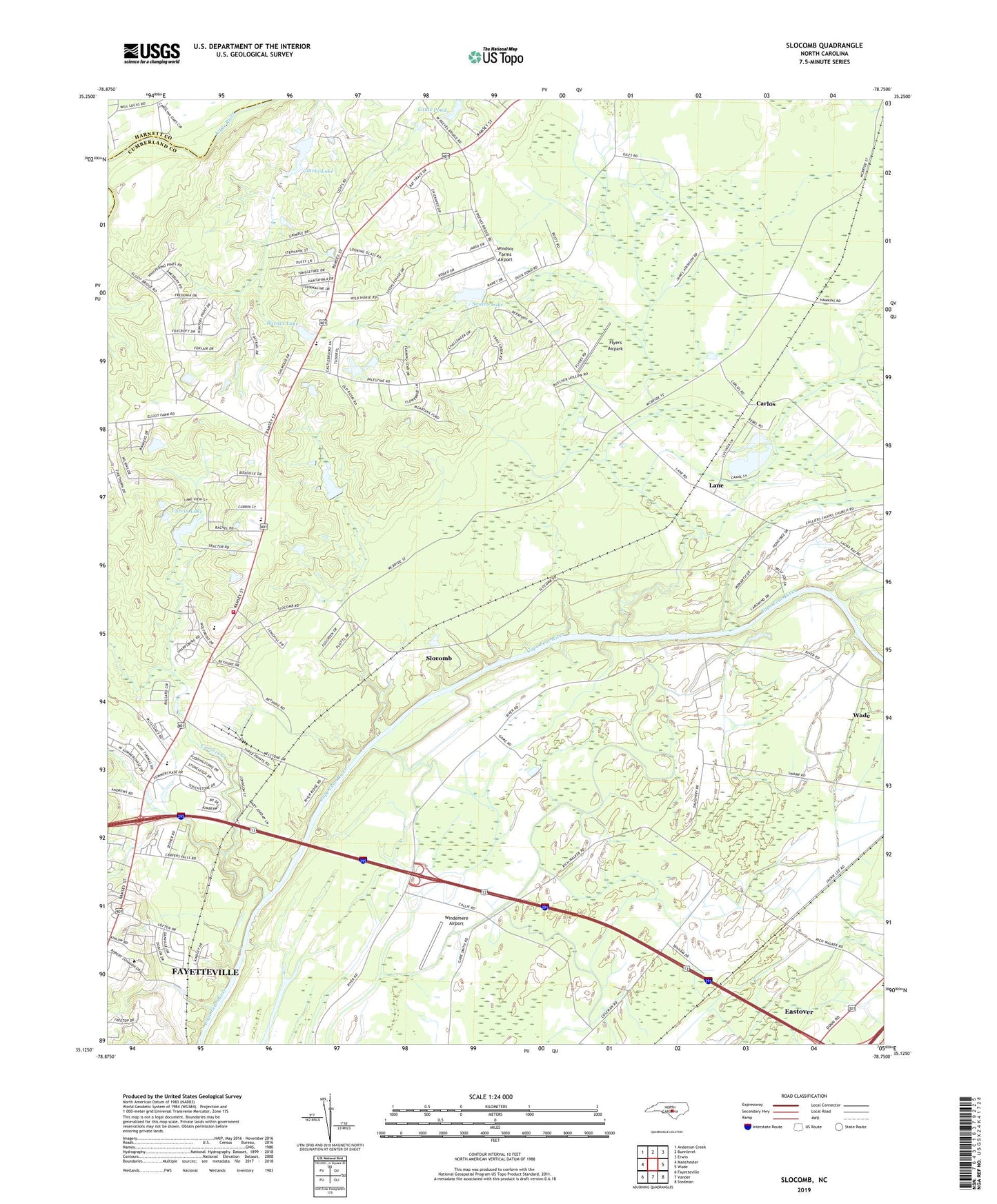
2022 topographic map quadrangle Slocomb in the state of North Carolina. Scale: 1:24000. Based on the newly updated USGS 7.5' US Topo map series, this map is in the following counties: Cumberland, Harnett. The map contains contour data, water features, and other items you are used to seeing on USGS maps, but also has updated roads and other features. This is the next generation of topographic maps. Printed on high-quality waterproof paper with UV fade-resistant inks.
Quads adjacent to this one:
West: Manchester
Northwest: Anderson Creek
North: Bunnlevel
Northeast: Erwin
East: Wade
Southeast: Stedman
South: Vander
Southwest: Fayetteville
This map covers the same area as the classic USGS quad with code o35078b7.
Contains the following named places: Barnes Lake, Barnes Lake Dam, Carlos, Carvers Creek, Cedar Falls Church, Clarks Lake, Clarks Lake Dam, Currin Lake, Currin Lake Dam, Ennis Pond, Flyers Airpark, Lane, Long Hill School, Methodist College, Palestine Church, Raleigh Road Kindergarten, Slocomb, Smith Lake Dam, Smiths Lake, Township of Carvers Creek, Westarea Volunteer Fire Department, Windemere Airport, Windsor Farms Airport, Zion Church, ZIP Code: 28356