MyTopo
Wade North Carolina US Topo Map
Couldn't load pickup availability
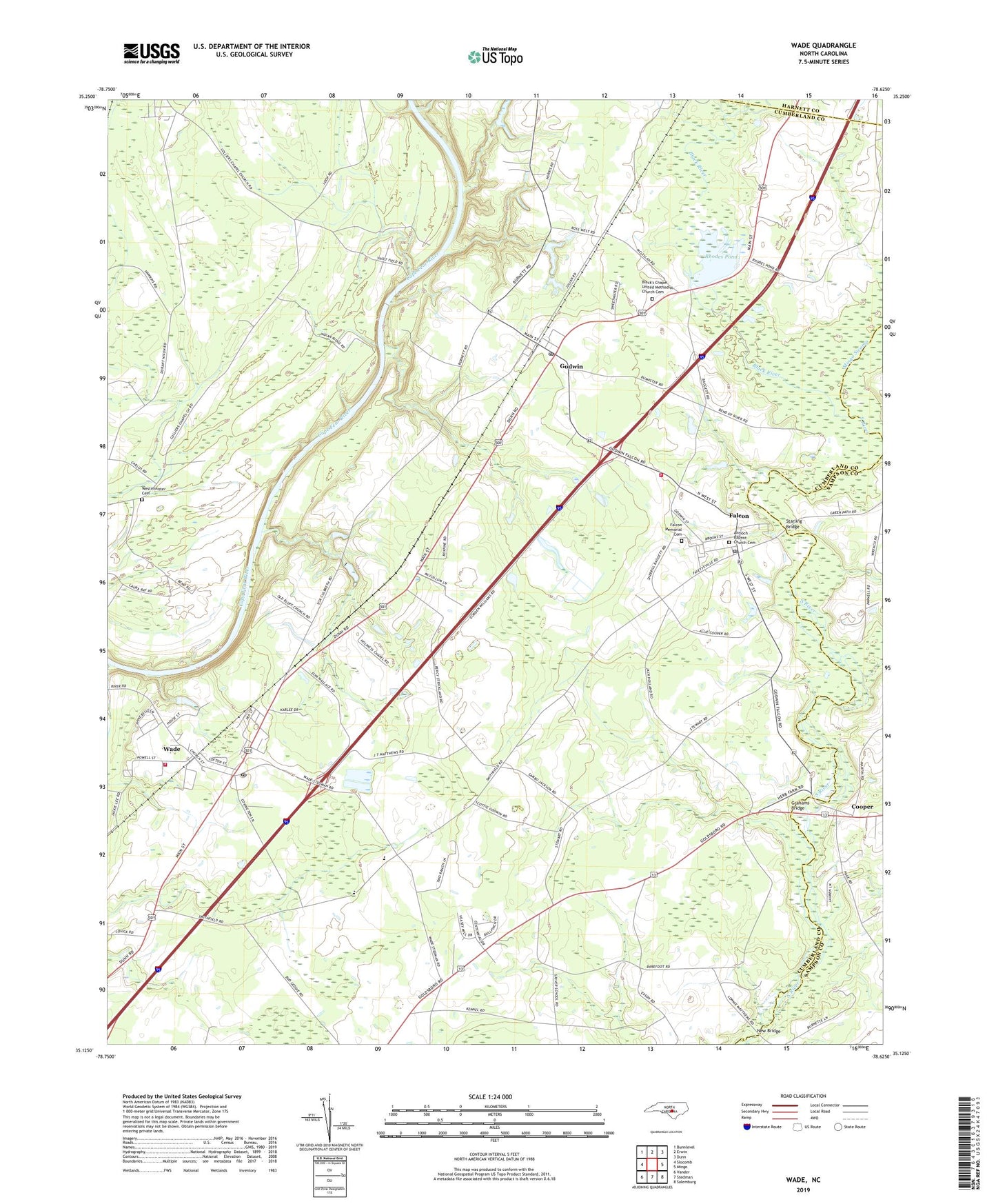
2022 topographic map quadrangle Wade in the state of North Carolina. Scale: 1:24000. Based on the newly updated USGS 7.5' US Topo map series, this map is in the following counties: Cumberland, Sampson, Harnett. The map contains contour data, water features, and other items you are used to seeing on USGS maps, but also has updated roads and other features. This is the next generation of topographic maps. Printed on high-quality waterproof paper with UV fade-resistant inks.
Quads adjacent to this one:
West: Slocomb
Northwest: Bunnlevel
North: Erwin
Northeast: Dunn
East: Mingo
Southeast: Salemburg
South: Stedman
Southwest: Vander
This map covers the same area as the classic USGS quad with code o35078b6.
Contains the following named places: Antioch Baptist Church Cemetery, Antioch Church, Averasboro Battleground Monument, Black River, Blacks Chapel, Black's Chapel United Methodist Church Cemetery, Bluff Church, Coharie State Designated Tribal Statistical Area, Colliers Chapel, Cooper, Culbreth Memorial Church, District Number 7 Elementary School, Elizabeth Church, Emmanuel Church, Falcon, Falcon Memorial Cemetery, Falcon Post Office, Friendship Church, Godwin, Godwin - Falcon Fire Department, Godwin Post Office, Grahams Bridge, Holiness Chapel, McMillan Church, Mingo Swamp, Mount Olive Church, Mount Zion Church, New Bridge, Oak Ridge Church, Old Bluff Church, Revival Center Church, Rhodes Pond, Rhodes Pond Dam, Spring Hill Church, Starling Bridge, Town of Falcon, Town of Godwin, Town of Wade, Township of Black River, Wade, Wade Community Fire Department, Wade Post Office, Wesley Chapel, Westminster Cemetery, WIDO-FM (Dunn), Williams Chapel, Williamson Swamp, Zion Wall Church, ZIP Codes: 28342, 28395