MyTopo
Farmville North Carolina US Topo Map
Couldn't load pickup availability
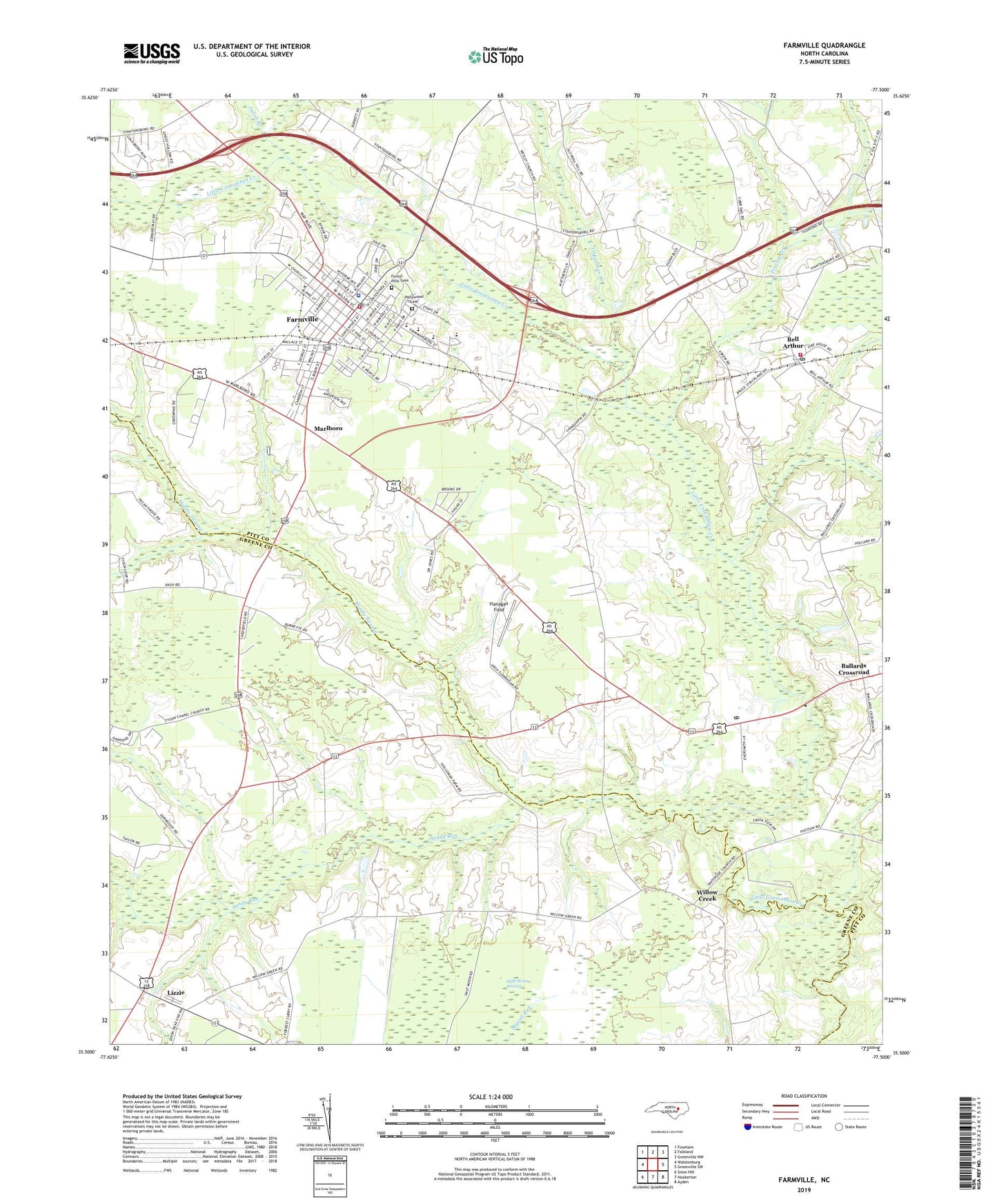
2019 topographic map quadrangle Farmville in the state of North Carolina. Scale: 1:24000. Based on the newly updated USGS 7.5' US Topo map series, this map is in the following counties: Pitt, Greene. The map contains contour data, water features, and other items you are used to seeing on USGS maps, but also has updated roads and other features. This is the next generation of topographic maps. Printed on high-quality waterproof paper with UV fade-resistant inks.
Quads adjacent to this one:
West: Walstonburg
Northwest: Fountain
North: Falkland
Northeast: Greenville NW
East: Greenville SW
Southeast: Ayden
South: Hookerton
Southwest: Snow Hill
Contains the following named places: Advent Church, Ballards Crossroad, Beacon Church, Bell Arthur, Bell Arthur Census Designated Place, Bell Arthur Fire Department, Bellarthur Post Office, Birchwood, Black Swamp, Bright Leaf Shopping Center, Caswell Center, Community Church, Contentea Campground, Crafts Airport, En-Power Disciple Church Ministries, Farmville, Farmville Community Center, Farmville Country Club, Farmville Fire Department, Farmville Healthcare Center, Farmville Middle School, Farmville Police Department, Farmville Post Office, Farmville Rescue and Emergency Medical Services, Farmville Square Shopping Center, Farmville Town Hall, Flanagan Field, Forest Hills Cemetery, H B Sugg Elementary School, Half Moon Pocosin, Harpers Chapel, High School, Hollywood Cemetery, J Y Monk Park, Jacob Branch, Kittrell Hill, Lakeside Fore Mobile Home Park, Lanes Crossroads - Mobile Home Park, Lizzie, Marlboro, Marlboro Church, Marlboro Forest, Matthews Mobile Home Park, Middle School, Middle Swamp, Mount Herman Church, Moyes Chapel, Municipal Athletic Park, North Ridge, Oldwoman Branch, Patrick Chapel, Pinelog Branch, Pleasant Mount Post Office, Saint Johns Church, Saint Pauls Church, Sam D Bundy Elementary School, Sandy Run, Town of Farmville, Township of Farmville, Township of Olds, Tysons Chapel, Tysons Church, Waterside Church, Watkins Way Mobile Home Park, WFAG, WGHB-AM (Farmville), Willow Creek, WRQR-FM (Farmville), WUNK-TV (Greenville), ZIP Code: 27828