MyTopo
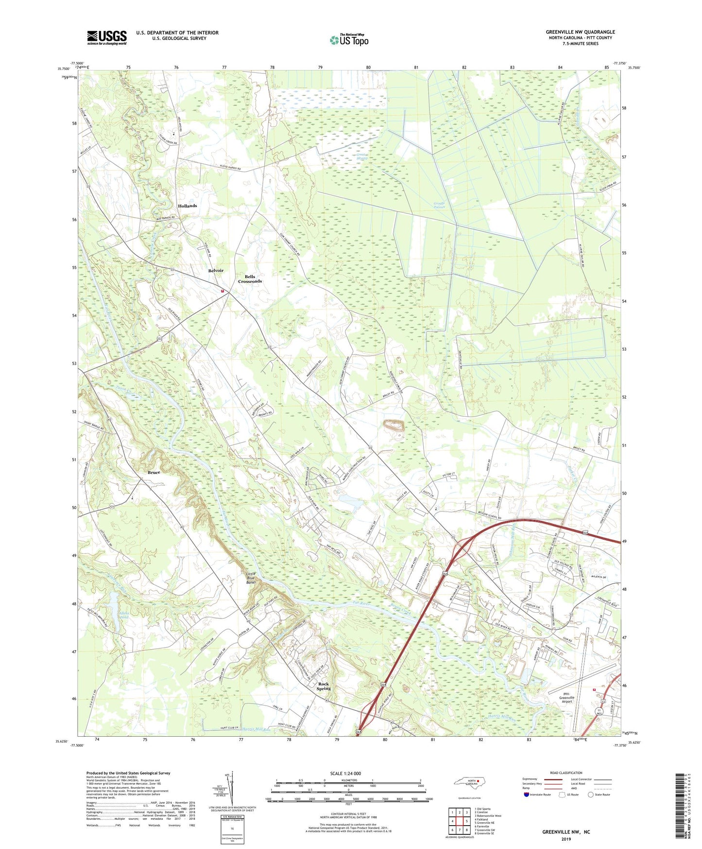
Greenville NW North Carolina US Topo Map
Couldn't load pickup availability
2022 topographic map quadrangle Greenville NW in the state of North Carolina. Scale: 1:24000. Based on the newly updated USGS 7.5' US Topo map series, this map is in the following counties: Pitt. The map contains contour data, water features, and other items you are used to seeing on USGS maps, but also has updated roads and other features. This is the next generation of topographic maps. Printed on high-quality waterproof paper with UV fade-resistant inks.
Quads adjacent to this one:
West: Falkland
Northwest: Old Sparta
North: Conetoe
Northeast: Robersonville West
East: Greenville NE
Southeast: Greenville SE
South: Greenville SW
Southwest: Farmville
This map covers the same area as the classic USGS quad with code o35077f4.
Contains the following named places: Allens Pond, Bells Crossroads, Belvoir, Belvoir Census Designated Place, Belvoir Church, Belvoir School, Belvoir Volunteer Fire Department, Birchwoods Sands Mobile Home Park, Blue Banks Landing, Boyd Memorial Presbyterian Church, Brown Chapel, Browns Ferry, Browns Old Ferry, Bruce, Bryan Creek, Calvary Church, Center Bluff Landing, Clark Banks, Conetoe Creek, Country Paradise Mobile Home Park, Eagle Ridge Mobile Home Park, Eastwood Mobile Home Park, Edward R Murrow Transmitting Station of Voice of America, Falkland School, Flemings Chapel, Great Swamp, Grindle Pocosin, Gum Swamp Church, Harris Mill Run, Hearns Landing, Hollands, Holly Hill Church, Holy Temple, Johnsons Mill Run, Little Blue Banks, Mount Pleasant Church, NC Noname Eight-Hundred Forty-Seven Dam, New Hope Church, Noahs Ark Fishing Deliverance Church, Otter Creek, Parker Landing, Peeples Landing, Pillsboro Landing, Pitt - Greenville Airport Authority Fire Department, Pitt-Greenville Airport, Randolph Landing, River Road Minor, Rock Spring, Rock Spring Church, Sains Branch, Township of Belvoir, Tyson Creek, USAR Center, Victory Mobile Home Park, WeCare Residential Facility, ZIP Code: 27834


