MyTopo
Fremont North Carolina US Topo Map
Couldn't load pickup availability
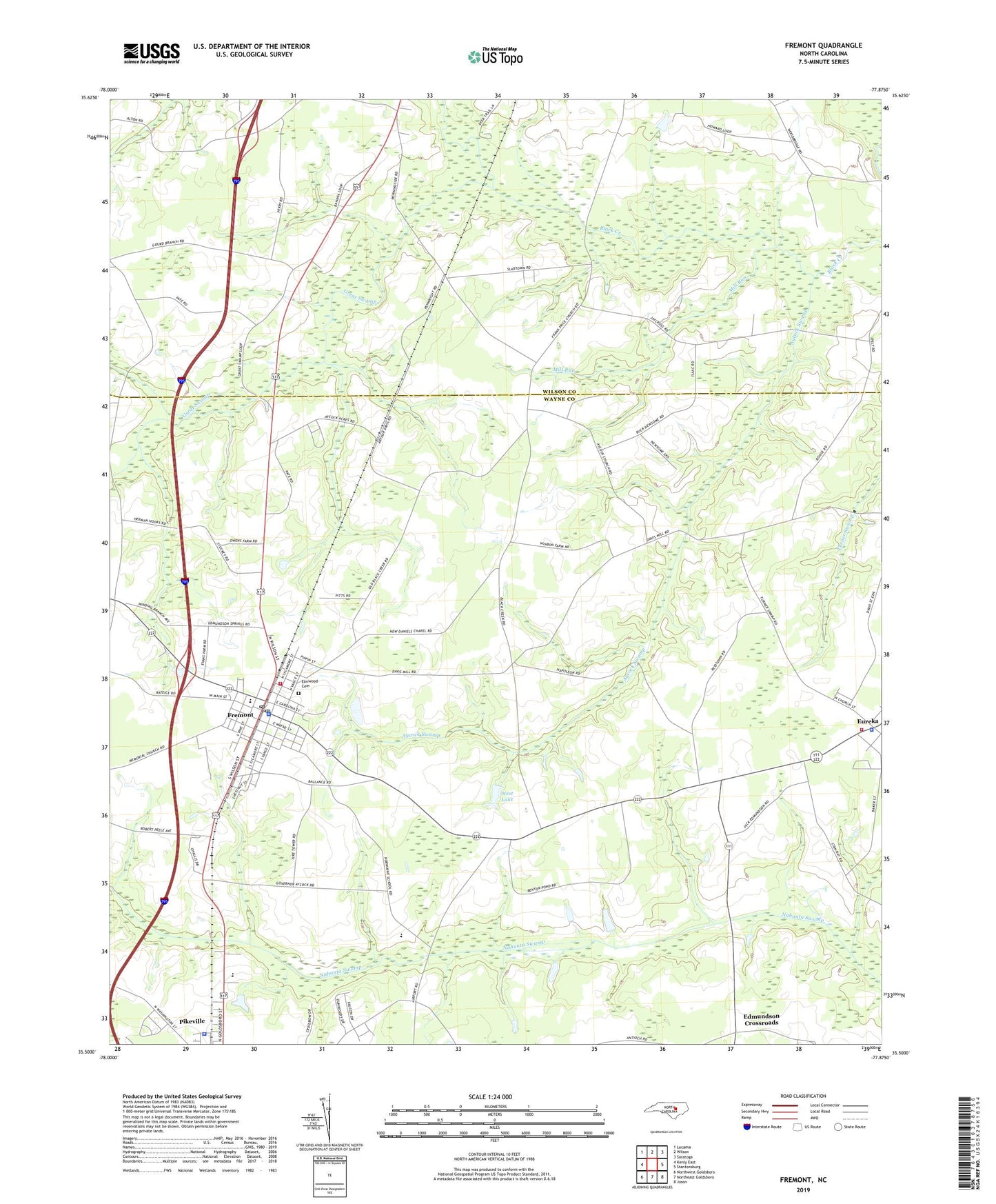
2022 topographic map quadrangle Fremont in the state of North Carolina. Scale: 1:24000. Based on the newly updated USGS 7.5' US Topo map series, this map is in the following counties: Wayne, Wilson. The map contains contour data, water features, and other items you are used to seeing on USGS maps, but also has updated roads and other features. This is the next generation of topographic maps. Printed on high-quality waterproof paper with UV fade-resistant inks.
Quads adjacent to this one:
West: Kenly East
Northwest: Lucama
North: Wilson
Northeast: Saratoga
East: Stantonsburg
Southeast: Jason
South: Northeast Goldsboro
Southwest: Northwest Goldsboro
This map covers the same area as the classic USGS quad with code o35077e8.
Contains the following named places: Aycock Church, Aycock High School, Aycock Swamp, Collingwood Estates, Edmundson Crossroads, Elmwood Cemetery, Eureka, Eureka Police Department, Eureka Post Office, Eureka Volunteer Fire Department - Northeast Station 2, Frank Price Church, Fremont, Fremont Elementary School, Fremont Emergency Services, Fremont Police Department, Fremont Post Office, Fremont Volunteer Fire Department, Great Swamp, Hooks Grove Church, Mill Run, Mount Nelson Church, New Bethel Church, New Daniels Chapel, Norwayne School, Pikeville Elementary School, Pikeville Police Department, Town of Eureka, Town of Fremont, Township of Nahunta, Turner Swamp Church, West Lake, West Lake Dam, ZIP Code: 27830