MyTopo
Grandin North Carolina US Topo Map
Couldn't load pickup availability
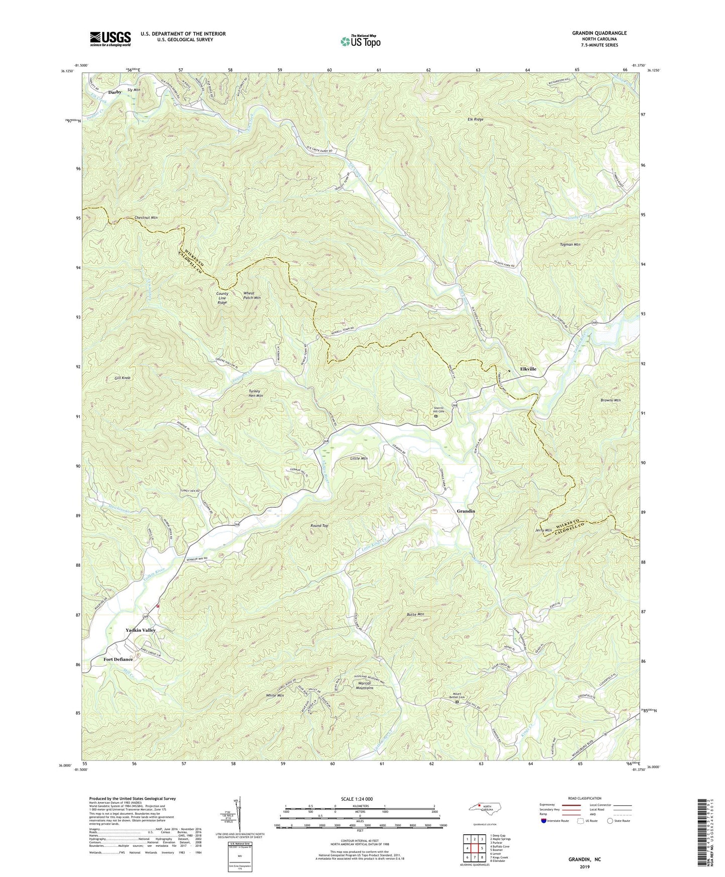
2019 topographic map quadrangle Grandin in the state of North Carolina. Scale: 1:24000. Based on the newly updated USGS 7.5' US Topo map series, this map is in the following counties: Caldwell, Wilkes. The map contains contour data, water features, and other items you are used to seeing on USGS maps, but also has updated roads and other features. This is the next generation of topographic maps. Printed on high-quality waterproof paper with UV fade-resistant inks.
Quads adjacent to this one:
West: Buffalo Cove
Northwest: Deep Gap
North: Maple Springs
Northeast: Purlear
East: Boomer
Southeast: Ellendale
South: Kings Creek
Southwest: Lenoir
Contains the following named places: Blue Creek, Browns Mountain, Butte Mountain, Chestnut Mountain, Cilley, County Line Ridge, Darby, Denny, Denny Station, Dugger Creek, Elk Church, Elk Creek, Elkville, Fort Defiance, German Chapel, Gill Knob, Grandin, Grandin Baptist Church, Hawkins Creek, Jerry Mountain, Kings Creek, Laurel Hills Church, Laytown Creek, Lenoir, Little Kings Creek, Little Mountain, Livingston Memorial Church, Maria Chapel, Mill Creek, Mount Bethel Cemetery, Mount Bethel Church, New Hope Church, Patterson Grove Church, Piney Grove Church, Rock Island Church, Round Top, Sherrill Hill Cemetery, Sly Mountain, Township of Elk, Township of Kings Creek, Tugman Mountain, Turkey Hen Mountain, Warrior Mountains, Wheat Patch Mountain, White Mountain, Yadkin Valley, Yadkin Valley Volunteer Fire Department, Yates Creek