MyTopo
Purlear North Carolina US Topo Map
Couldn't load pickup availability
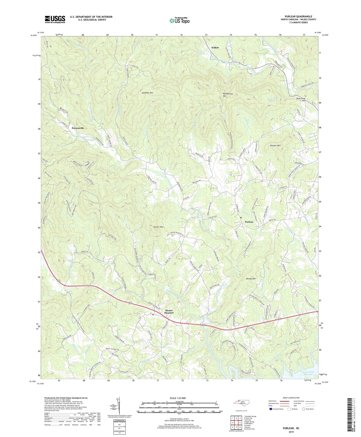
2022 topographic map quadrangle Purlear in the state of North Carolina. Scale: 1:24000. Based on the newly updated USGS 7.5' US Topo map series, this map is in the following counties: Wilkes. The map contains contour data, water features, and other items you are used to seeing on USGS maps, but also has updated roads and other features. This is the next generation of topographic maps. Printed on high-quality waterproof paper with UV fade-resistant inks.
Quads adjacent to this one:
West: Maple Springs
Northwest: Glendale Springs
North: Horse Gap
Northeast: McGrady
East: Wilkesboro
Southeast: Moravian Falls
South: Boomer
Southwest: Grandin
This map covers the same area as the classic USGS quad with code o36081b3.
Contains the following named places: Arbor Grove United Methodist Church, Boiling Springs Church, Bullis Tabernacle Church, Champion Fire Department, Charity Church, Coal Creek, Congo, Congo Hill Church, Deep Ford Hill, Dicks Hollow School, Dunkirk Church, Hamby Mountain, Hays Arbor, Hays Mill, Hoover Mountain, Huffman Branch, Huffman Mountain, Jones Creek, Leather Hinge School, Lewis Fork Church, Little Fork Creek, Meadow Branch, Middle Fork Reddies River, Millers Creek Volunteer Fire Department Station 2, Mount Pleasant, Mount Pleasant Church, Naked Creek, New Hope Church, North Fork Reddies River, North Prong Lewis Fork, Parsonville, Pilgrim Church, Purlear, Purlear Church, Purlear Creek, Purlear Post Office, Quarry Branch, Ready Branch, Rendezvous Mountain, Rendezvous Mountain State Park, Sandy Creek, Sharper Mountain, Smitheys Creek, Smitheys Creek Public Use Area, South Fork Reddies River, South Prong Lewis Fork, Staunton, Stony Hill Church, Township of Lewis Fork, Township of Stanton, Twomile Branch, West High School, White Oak Church, Wilbar, Yadkin Valley Church