MyTopo
Grays Chapel North Carolina US Topo Map
Couldn't load pickup availability
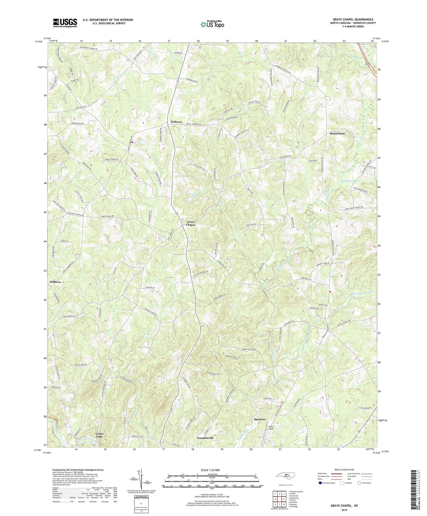
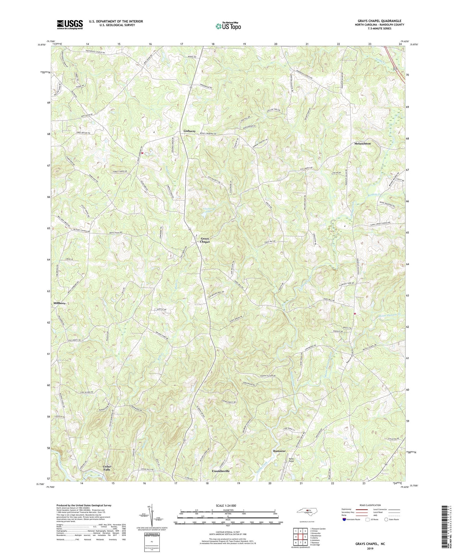
2019 topographic map quadrangle Grays Chapel in the state of North Carolina. Scale: 1:24000. Based on the newly updated USGS 7.5' US Topo map series, this map is in the following counties: Randolph. The map contains contour data, water features, and other items you are used to seeing on USGS maps, but also has updated roads and other features. This is the next generation of topographic maps. Printed on high-quality waterproof paper with UV fade-resistant inks.
Quads adjacent to this one:
West: Randleman
Northwest: Pleasant Garden
North: Climax
Northeast: Kimesville
East: Liberty
Southeast: Coleridge
South: Ramseur
Southwest: Asheboro
Contains the following named places: B J Poultry Farm, Boodom Creek, Cedar Falls, Clear View Church, Climax Fire Department Station 42, Cool Springs Church, Faith Temple Church, Franklinville Fire Department Station 22, Gabriels Creek, Grace Church, Grays Chapel, Grays Chapel Elementary School, Linberry, Lineberry Lake, Lineberry Lake Dam, Melanchton, Millboro, Mount Pleasant Creek, Patterson Grove Church, Providence Church, Randolph Church, Redcross Church, Rising Meadow Farm, Sandy Creek Church, Sandy Creek Mission, Township of Franklinville, Township of Providence, Whites Chapel, Whites Memorial Church, Yorks Field, ZIP Code: 27248