MyTopo
Climax North Carolina US Topo Map
Couldn't load pickup availability
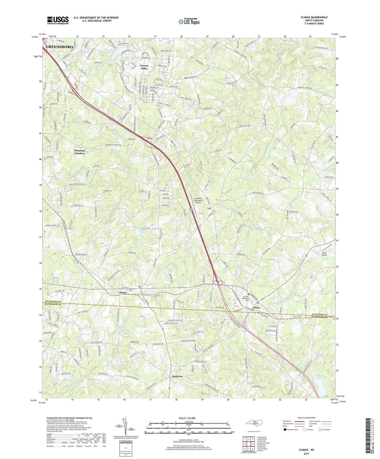
2022 topographic map quadrangle Climax in the state of North Carolina. Scale: 1:24000. Based on the newly updated USGS 7.5' US Topo map series, this map is in the following counties: Guilford, Randolph. The map contains contour data, water features, and other items you are used to seeing on USGS maps, but also has updated roads and other features. This is the next generation of topographic maps. Printed on high-quality waterproof paper with UV fade-resistant inks.
Quads adjacent to this one:
West: Pleasant Garden
Northwest: Greensboro
North: McLeansville
Northeast: Gibsonville
East: Kimesville
Southeast: Liberty
South: Grays Chapel
Southwest: Randleman
This map covers the same area as the classic USGS quad with code o35079h6.
Contains the following named places: Alamance Community Fire Department Station 44, Bethel Church, Bethlehem Church, Climax, Climax Creek, Climax Post Office, Climax Volunteer Fire Department STA 35, Colbe Church, Doctor Clyde M Gilmore Memorial Park, Dodson Lake Dam, Dodsons Lake, Forest Oaks, Forest Oaks Census Designated Place, Forest Oaks Lake, Forest Oaks Lake Dam, Hagan Stone Park, Julian, Julian Hill Church, Julian Post Office, Julian Volunteer Fire Department, Kecks Airport, Love Church, Lynwood Lakes Church, May Airport, Nelson Lake Dam, Nelsons Lake, Quaker Lake, Redcross, Reynolds Lake, Reynolds Lake Dam, Robbins Lake, Robbins Lake Dam, Rocking F Farm, Saint Johns Church, Shiloh Church, Southeast Greensboro Airport, Southeast High School, Southeast Junior High School, Southeast Volunteer Fire Department, Tabernacle Church, Teague Lake, Teague Lake Dam, Township of Clay, Township of Fentress, White Lake, White Lake Dam, ZIP Codes: 27233, 27283