MyTopo
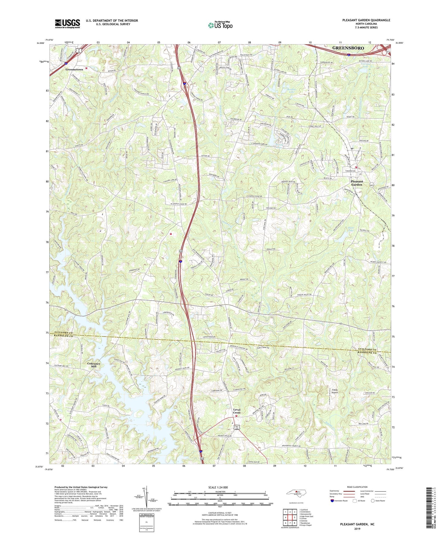
Pleasant Garden North Carolina US Topo Map
Couldn't load pickup availability
2022 topographic map quadrangle Pleasant Garden in the state of North Carolina. Scale: 1:24000. Based on the newly updated USGS 7.5' US Topo map series, this map is in the following counties: Guilford, Randolph. The map contains contour data, water features, and other items you are used to seeing on USGS maps, but also has updated roads and other features. This is the next generation of topographic maps. Printed on high-quality waterproof paper with UV fade-resistant inks.
Quads adjacent to this one:
West: High Point East
Northwest: Guilford
North: Greensboro
Northeast: McLeansville
East: Climax
Southeast: Grays Chapel
South: Randleman
Southwest: Glenola
This map covers the same area as the classic USGS quad with code o35079h7.
Contains the following named places: Benbow Lake, Benbow Lake Dam, Bullock School, Burnetts Chapel, Camp Douglas Long, Cedar Square Church, Centre Church, Coltranes Mill, Community Church, Concord Church, Fields Airport, Galilee Church, Good Hope Church, Green Valley Farm, Groome Sand Rock Pit, Groometown, Guil - Rand Fire Department Station 41, Hickory Creek, Hunt Lake, Hunt Lake Dam, Lakeview Church, Level Cross, Level Cross Voluntary Fire Department, Pinecroft - Sedgefield Fire District Station 24, Pinecroft - Sedgefield Fire District Station 25, Pleasant Garden, Pleasant Garden Elementary School, Pleasant Garden Fire Department Station 3, Pleasant Garden Post Office, Reddicks Creek, Rehobeth Church, Ritters Lake, Southern Guilford High School, Sumner Church, Sumner School, Town of Pleasant Garden, Township of Level Cross, Township of Sumner, White Rock Church, Wood Lake, Wood Lake Dam, Yowland Lake, Yowland Lake Dam, ZIP Code: 27313