MyTopo
Greenville NE North Carolina US Topo Map
Couldn't load pickup availability
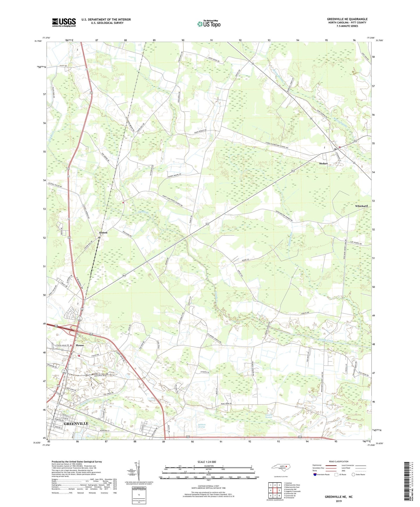
2019 topographic map quadrangle Greenville NE in the state of North Carolina. Scale: 1:24000. Based on the newly updated USGS 7.5' US Topo map series, this map is in the following counties: Pitt. The map contains contour data, water features, and other items you are used to seeing on USGS maps, but also has updated roads and other features. This is the next generation of topographic maps. Printed on high-quality waterproof paper with UV fade-resistant inks.
Quads adjacent to this one:
West: Greenville NW
Northwest: Conetoe
North: Robersonville West
Northeast: Robersonville East
East: Leggetts Crossroads
Southeast: Grimesland
South: Greenville SE
Southwest: Greenville SW
Contains the following named places: Alwood Post Office, Buck Mobil Home Park, Burning Bush Church, Cannon Swamp, Carson Memorial Church, Chad Mobile Home Park, Cherry Lane Church, Ebenezer Seventh Day Adventist Church, Greenfield Terrace, Greenville Fire and Rescue Station 4, Greenville Industrial Area, Grindle Creek Church, House, Kingdom Hall of Jehovahs Witnesses, Langley, Meadowbrook, Minnie Bert, North Pitt High School, Parkers Chapel F W B Church, Pitt County Emergency Medical Services Station 21, Post Oak Grove Church, Potters Place, River Park North, Saint Johns Church, Saint Mary Church, Saint Peters Missionary Baptist Church, Shady Knoll Mobile Estates, Staton, Staton House Fire and Rescue Station 2, Staton House Fire Department Station 14, Stokes, Stokes Census Designated Place, Stokes Fire Department - Station 1, Stokes Post Office, Sweet Gum Grove Church, Sycamore Chapel, Township of Carolina, Truth Temple Church of God, United Industrial Park, Wellcome Middle School, Westwood Mobile Home Park, Whichard, ZIP Code: 27884