MyTopo
Conetoe North Carolina US Topo Map
Couldn't load pickup availability
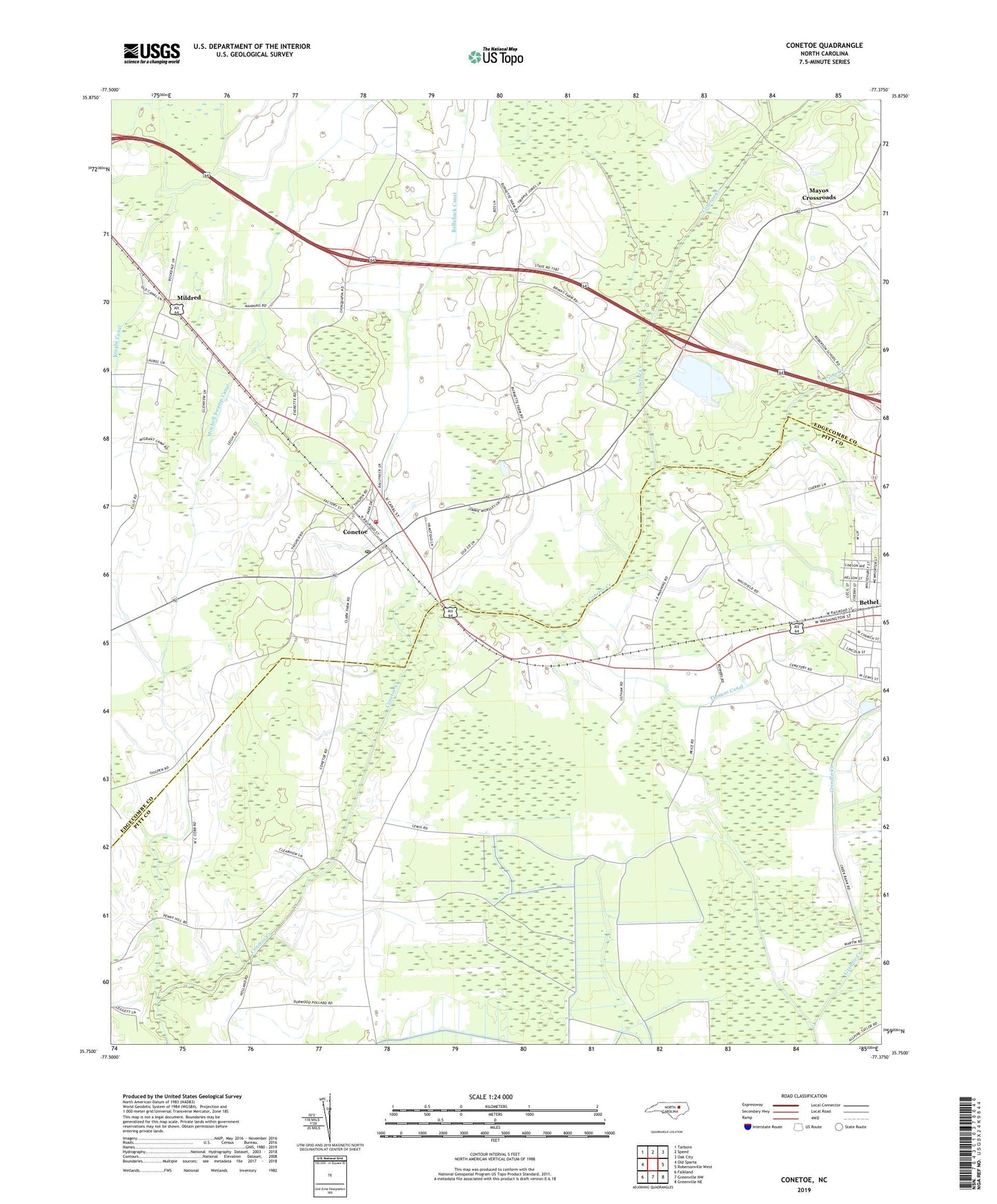
2022 topographic map quadrangle Conetoe in the state of North Carolina. Scale: 1:24000. Based on the newly updated USGS 7.5' US Topo map series, this map is in the following counties: Edgecombe, Pitt. The map contains contour data, water features, and other items you are used to seeing on USGS maps, but also has updated roads and other features. This is the next generation of topographic maps. Printed on high-quality waterproof paper with UV fade-resistant inks.
Quads adjacent to this one:
West: Old Sparta
Northwest: Tarboro
North: Speed
Northeast: Oak City
East: Robersonville West
Southeast: Greenville NE
South: Greenville NW
Southwest: Falkland
This map covers the same area as the classic USGS quad with code o35077g4.
Contains the following named places: Ballahack Canal, Bethel, Conetoe, Conetoe Post Office, Conetoe Volunteer Fire Department and Emergency Medical Services, Crisp Creek, Dogtown, Fountain Fork Creek, Johnson Church, Lewis Canal, Mayos Crossroads, Mildred, Thomas Canal, Town of Bethel, Town of Conetoe, Township 2-Lower Conetoe, ZIP Code: 27819