MyTopo
Hampstead North Carolina US Topo Map
Couldn't load pickup availability
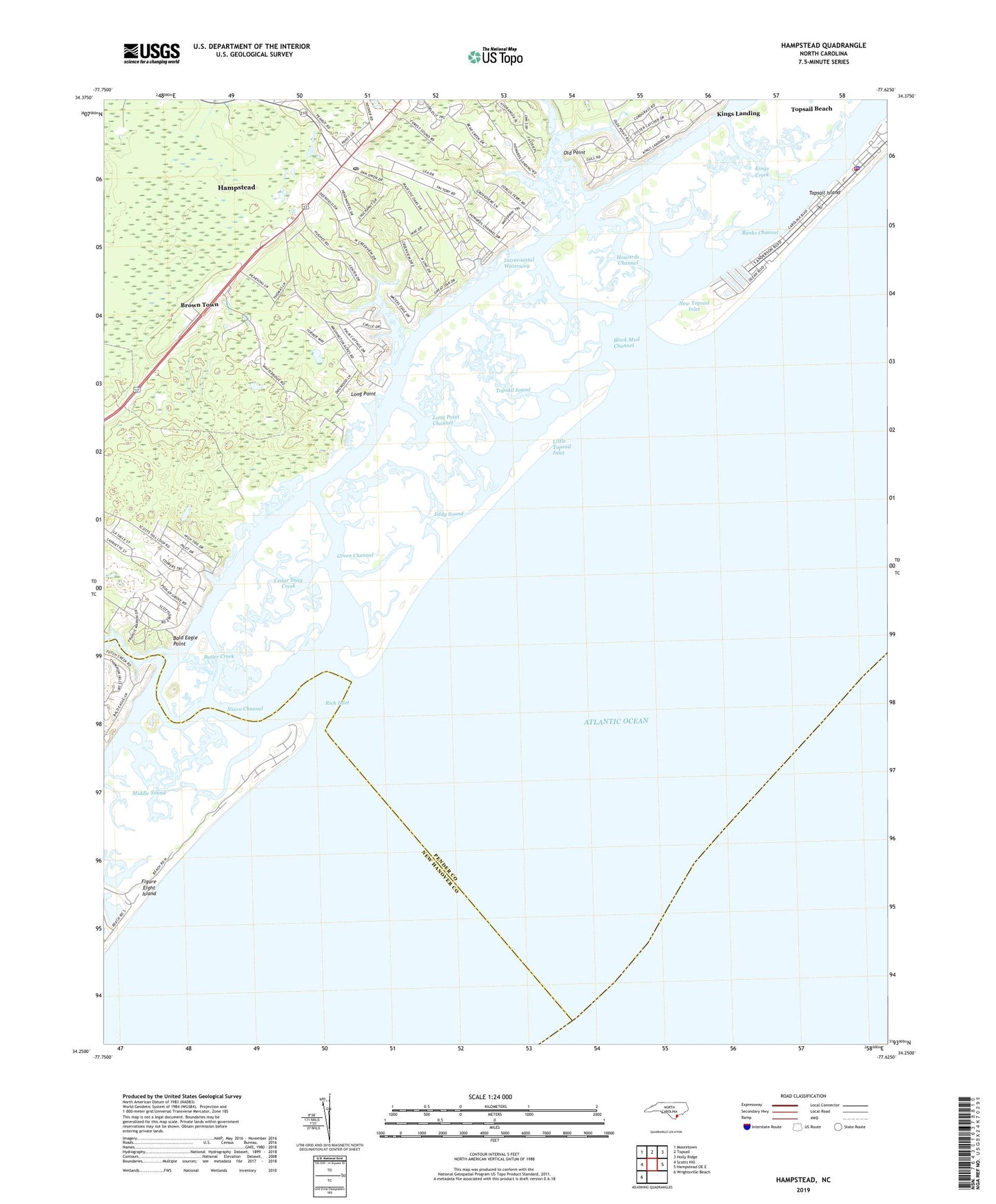
2022 topographic map quadrangle Hampstead in the state of North Carolina. Scale: 1:24000. Based on the newly updated USGS 7.5' US Topo map series, this map is in the following counties: Pender, New Hanover. The map contains contour data, water features, and other items you are used to seeing on USGS maps, but also has updated roads and other features. This is the next generation of topographic maps. Printed on high-quality waterproof paper with UV fade-resistant inks.
Quads adjacent to this one:
West: Scotts Hill
Northwest: Mooretown
North: Topsail
Northeast: Holly Ridge
East: Hampstead OE E
Southwest: Wrightsville Beach
This map covers the same area as the classic USGS quad with code o34077c6.
Contains the following named places: Bald Eagle Point, Banks Channel, Bellamy Landing, Black Mud Channel, Brown Town, Butler Creek, Cedar Snag Creek, Eddy Sound, Factory Landing, Figure Eight Island, Futch Creek, Green Channel, Hampstead, Hampstead Baptist Church, Hampstead Census Designated Place, Hampstead Post Office, Hampstead Shopping Center, Howard Channel, Howard Landing, Howards Channel, Kings Creek, Kings Landing, Little Topsail Inlet, Long Point, Long Point Channel, Mill Creek, New Topsail Inlet, Nixon Channel, Notts Mobile Home Home Park, Old Point, Old Point Landing, Old Topsail Creek, Pender Volunteer Emergency Medical Services and Rescue Station 4, Porters Neck Plantation, Rich Inlet, Saint Johns Church, Scotts Hill Marina, Sidbury Landing, Topsail Beach, Topsail Beach Fire Department, Topsail Beach Police Department, Topsail High School, Topsail Sound, Town of Topsail Beach