MyTopo
Rose Hill North Carolina US Topo Map
Couldn't load pickup availability
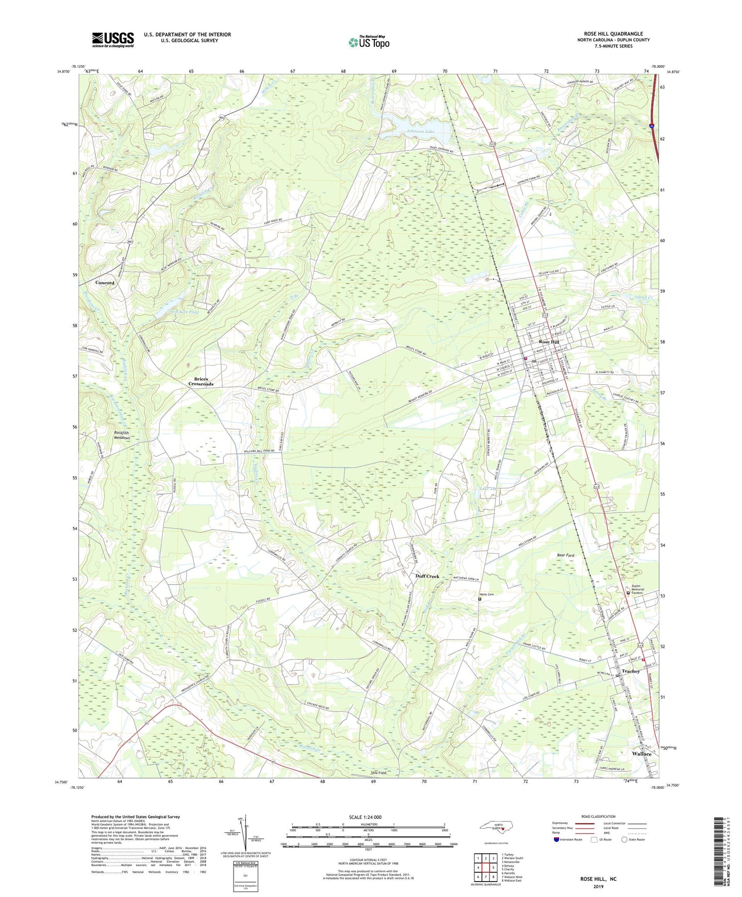
2022 topographic map quadrangle Rose Hill in the state of North Carolina. Scale: 1:24000. Based on the newly updated USGS 7.5' US Topo map series, this map is in the following counties: Duplin. The map contains contour data, water features, and other items you are used to seeing on USGS maps, but also has updated roads and other features. This is the next generation of topographic maps. Printed on high-quality waterproof paper with UV fade-resistant inks.
Quads adjacent to this one:
West: Delway
Northwest: Turkey
North: Warsaw South
Northeast: Kenansville
East: Charity
Southeast: Wallace East
South: Wallace West
Southwest: Harrells
This map covers the same area as the classic USGS quad with code o34078g1.
Contains the following named places: Bear Ford, Betholite Church, Big Beaverdam Creek, Brices Crossroads, Cabin Branch, Concord, Corinth Church, Duff Creek, Duplin County Emergency Medical Services Medic 7, Duplin Memorial Gardens, Friendship Church, Fussell Mill Branch, Jerome Park, Johnsons Lake, Lake Tut, Magnolia-Rose Hill School, Murpheys Creek, Nash Johnson Lake Dam, New Kirk Pond, New Kirk Pond Dam, North Branch, Providence Methodist Church, Rockfish Community Building, Rockfish Meadows, Rose Hill, Rose Hill Fire Department, Rose Hill Police Department, Rose Hill Post Office, Rose Hill Speedway, Rose Hill Wastewater Treatment Plant, Rosemary Crossing, Taylors Creek, Teachey, Teachey Post Office, Teachey Volunteer Fire Department, Town of Rose Hill, Town of Teachey, Township of Rockfish, Township of Rose Hill, WEGG-AM (Rose Hill), Wells Cemetery, ZIP Codes: 28458, 28464