MyTopo
Wallace West North Carolina US Topo Map
Couldn't load pickup availability
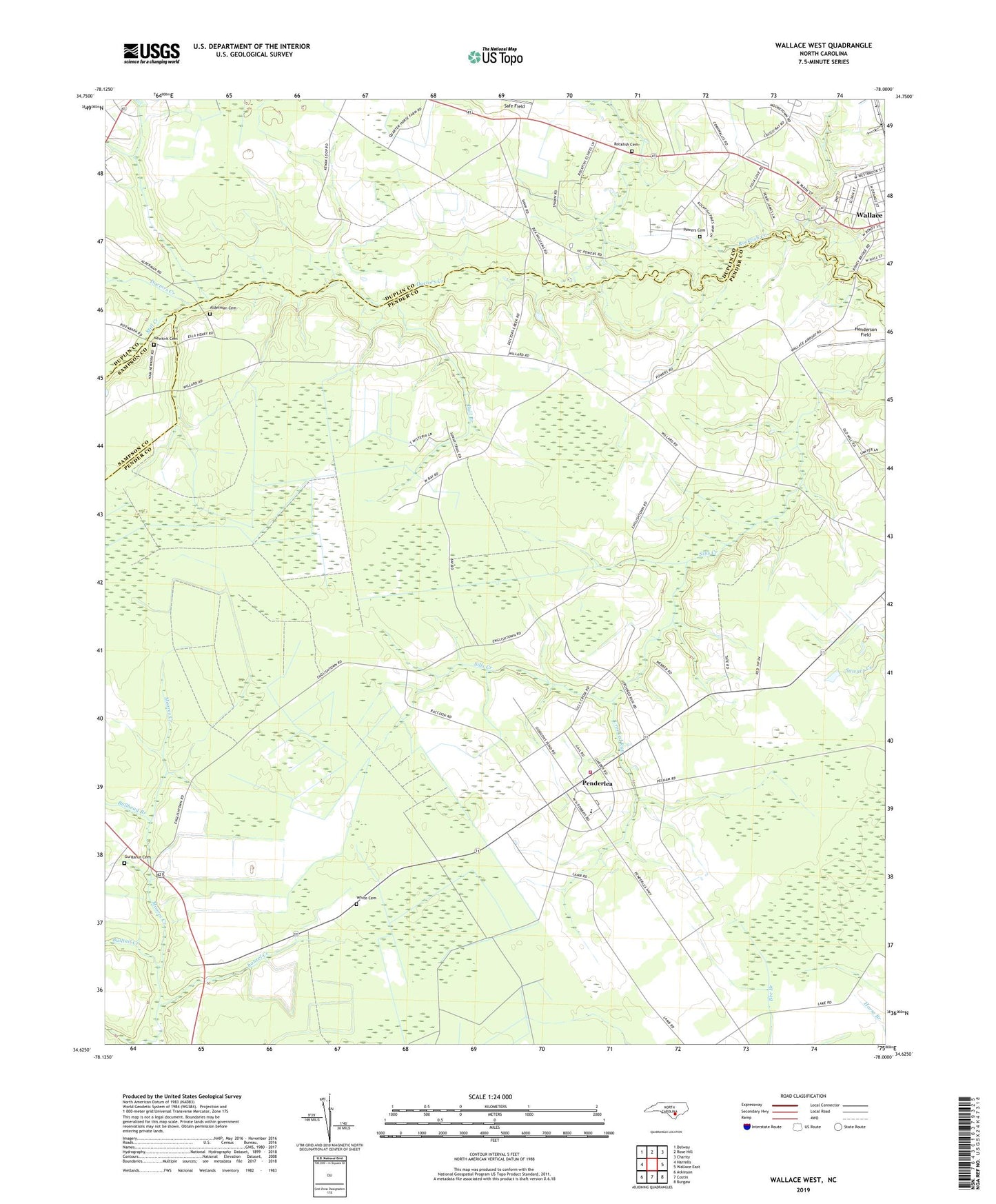
2022 topographic map quadrangle Wallace West in the state of North Carolina. Scale: 1:24000. Based on the newly updated USGS 7.5' US Topo map series, this map is in the following counties: Pender, Duplin, Sampson. The map contains contour data, water features, and other items you are used to seeing on USGS maps, but also has updated roads and other features. This is the next generation of topographic maps. Printed on high-quality waterproof paper with UV fade-resistant inks.
Quads adjacent to this one:
West: Harrells
Northwest: Delway
North: Rose Hill
Northeast: Charity
East: Wallace East
Southeast: Burgaw
South: Costin
Southwest: Atkinson
This map covers the same area as the classic USGS quad with code o34078f1.
Contains the following named places: Alderman Cemetery, Antioch Church, Bull Branch, Bullhead Branch, Bulltail Creek, Canaan Church, Corinth Church, Crooked Run, Doctors Creek, Gurganus Cemetery, Henderson Field, Laurel Creek, Meyer Field, Mill Creek, Mills Memorial Church, Newkirk Cemetery, Newkirk Chapel, Newkirk School, Penderlea, Penderlea Church, Penderlea School, Penderlea Volunteer Fire Department, Penile Church, Potts Memorial Church, Powers Cemetery, Rapture Church, Rockfish Cemetery, Rockfish Church, Safe, Safe Field, Saint John Church, Sunnyside, White Cemetery, ZIP Code: 28478