MyTopo
Harrellsville North Carolina US Topo Map
Couldn't load pickup availability
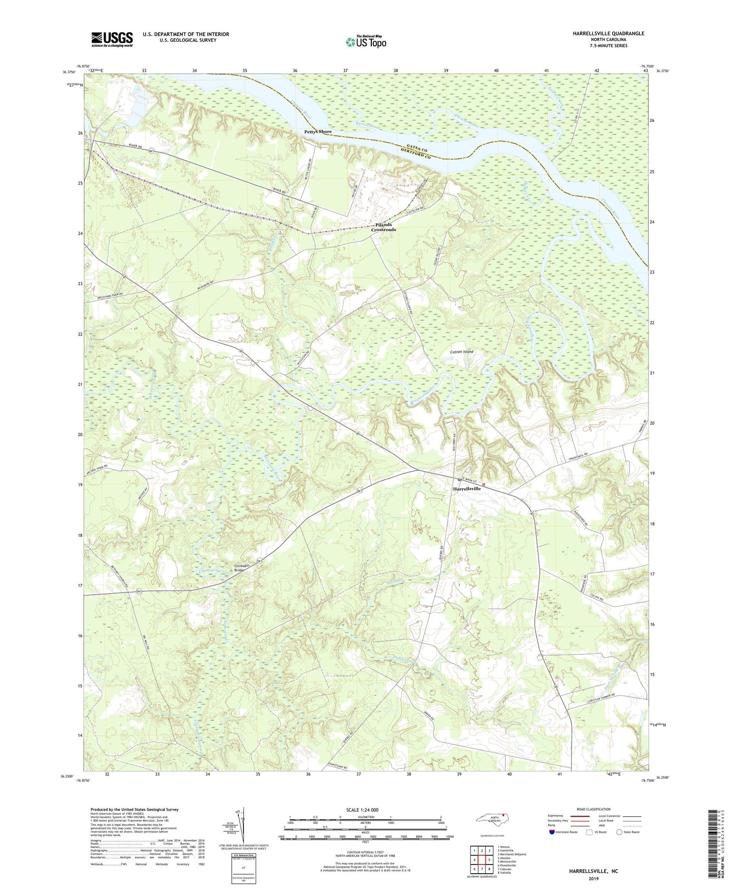
2019 topographic map quadrangle Harrellsville in the state of North Carolina. Scale: 1:24000. Based on the newly updated USGS 7.5' US Topo map series, this map is in the following counties: Hertford, Gates. The map contains contour data, water features, and other items you are used to seeing on USGS maps, but also has updated roads and other features. This is the next generation of topographic maps. Printed on high-quality waterproof paper with UV fade-resistant inks.
Quads adjacent to this one:
West: Ahoskie
Northwest: Winton
North: Gatesville
Northeast: Merchants Millpond
East: Mintonsville
Southeast: Valhalla
South: Colerain
Southwest: Powellsville
Contains the following named places: Barnes Creek, Boone Harrell Ferry, Brick Cellar Landing, Brooks Creek, Cedar Hill Fishery, Cedar Hill Landing, Cessons Mill, Cherry School, Chinkapin Bridge, Chinkapin Creek, Chinkapin Swamp, Cotton Island, Eure Landing, Flat Swamp, Harrellsville, Harrellsville Chapel, Harrellsville Post Office, Harrellsville Volunteer Fire Department Station 4, Hodges Creek, Island Creek, Lincoln Grove Church, Long Branch, Mitchell Landing, Mitchell Lodge, Mount Pleasant Church, New Bethany Church, Newsome Store, Pettys Shore, Pilands Crossroads, Pitch Landing, Pollock Lodge, Red Bank Landing, Redbank Lodge, Sarem Creek, Sculls Lodge, Sessoms Mill, Seulls Landing, Sharps Landing, Sharps Lodge, Shaw Landing, Snell Lodge, Tar Ferry, Town of Harrellsville, Township of Harrellsville, Wiccacon River, Wildcat Landing, ZIP Codes: 27922, 27942