MyTopo
Winton North Carolina US Topo Map
Couldn't load pickup availability
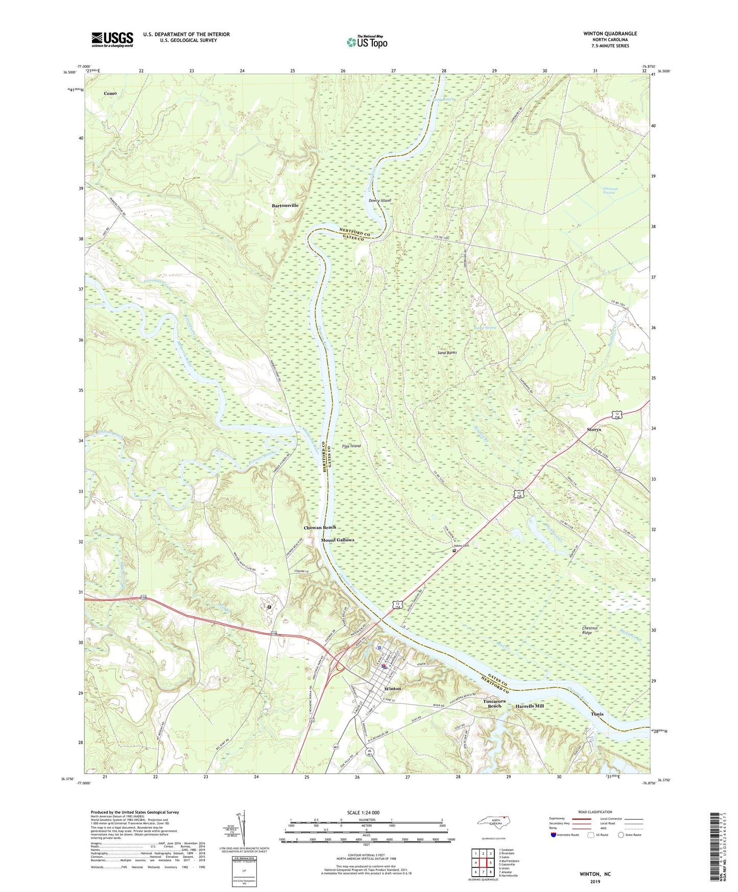
2022 topographic map quadrangle Winton in the state of North Carolina. Scale: 1:24000. Based on the newly updated USGS 7.5' US Topo map series, this map is in the following counties: Hertford, Gates. The map contains contour data, water features, and other items you are used to seeing on USGS maps, but also has updated roads and other features. This is the next generation of topographic maps. Printed on high-quality waterproof paper with UV fade-resistant inks.
Quads adjacent to this one:
West: Murfreesboro
Northwest: Sunbeam
North: Riverdale
Northeast: Gates
East: Gatesville
Southeast: Harrellsville
South: Ahoskie
Southwest: Union
This map covers the same area as the classic USGS quad with code o36076d8.
Contains the following named places: Askew Cemetery, Barfield Ferry, Bartonsville, Beasley Branch, Brittles Ferry, Brown School, Cady Landing, Catherine Creek, Chestnut Ridge, Chowan Beach, Deep Creek, Deep Creek Millpond Dam, Dowry Island, Dowry Landing, Dunns Fishery, Farmers Chemical Assoc Dam, Flax Island, Folley Branch, Gods Healing Cathedral, Harrells Mill, Hertford County Ambulance Service, Hertford County Library, Hertford County Sheriff's Office, Jones Ferry, Liverman Creek, Long Reach, Meherrin River, Mill Branch, Mill Pond, Mitchell Landing, Mount Gallows, Mount Moriah Church, Mud Creek, Mud Hole Fishery, No Grease, Parkers Ferry, Pipkin Place, Potecasi Creek, Run of Swamp, Sand Banks, Spring Landing, Spring Lodge, Storys, Town of Winton, Tunis, Tuscarora Beach, Winton, Winton Police Department, Winton Post Office, Winton Volunteer Fire Department, Winton Volunteer Rescue Squad, ZIP Code: 27986